The Following Pages on Roadfan.com
reference the National Road in Ohio (Going West to East)
Springfield
& US 40 in Western Ohio
Landmarks of Madison County
US 40 Bridge
over Big Darby Creek
West Broad St. Bridge (Over the Scioto River in
Columbus)
Downtown
Columbus Signage
Kirkersville
in Licking County
National
Rd in Eastern Ohio
Wheeling
(W.Va) Virtual Tour
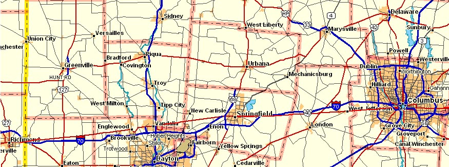
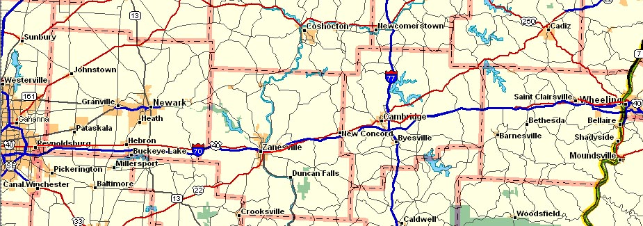
The maps below show the routing of the modern National
Rd through Ohio (going west to east...)
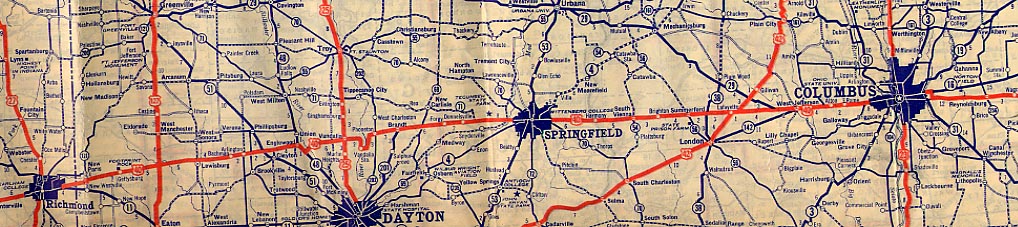
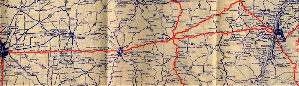
 As an added bonus, here is the 1930 routing of US 40
(National Road) through Ohio (going west to east, again...)
As an added bonus, here is the 1930 routing of US 40
(National Road) through Ohio (going west to east, again...)
 Other Websites about US 40/National
Road in Ohio
National Scenic Byway - National
Road
Other Websites about US 40/National
Road in Ohio
National Scenic Byway - National
Road
State of Ohio Scenic Byway - National
Road
route40.net
(maintained by Frank Brusca)
National
Road Photo Essay (by Adam Prince)
Blaine
Hill reconstruction Project (by Brian Powell)
FWHA Pages
Blaine Hill Bridge
The
National Road
Zane's
Trace
US 40 shields designed using Shields Up by David Kendrick
Modern Ohio map from Delormes, 1930 Ohio map from Rand McNally
Page created on April 30, 2004/last updated on July 9, 2005
Questions and comments can be directed to Sandor
Gulyas
Return to Ohio Regional Page