
Overlook of the city

This photo was taken from a lookout north of Downtown Wheeling. On your left is US 40. In the middle is the I-70 bridge between Wheeling and Wheeling Island with the National Road suspension bridge directly behind it. To your right, amongst the housing, is WVB 2. Towards the top of the photo, in the distance, is the I-470 bridge. (Photo taken in 2002)
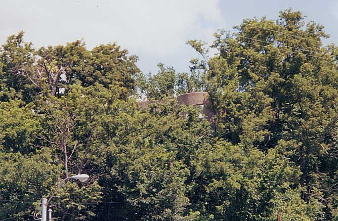
Hidden amongst the trees towards the top is the scenic lookout
that I took the photo of Wheeling (above) from. This lookout however
had seen better days as trash and graffiti were abundant around
there.
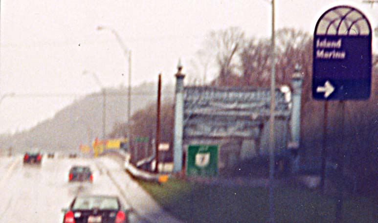
This photo was taken from the intersection
of US 40 and McCollochs St. (Photo taken in 2002)
Abandoned Truss bridge


Why was this bridge abandoned? This truss bridge was replaced by the current bridge (on the left on the top photo, on the right in the other two photos) for US 40 and US 250.
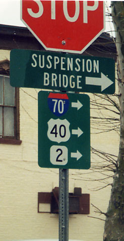
Sign directing anyone (somewhere) on Wheeling Island to the routes and the old Suspension bridge (from Wheeling Island to Mainland Wheeling) for the National Road.
The Old National Road Suspension Bridge

Cables from the side to hold the bridge steady?

Looking head on towards the bridge. You can still drive on the bridge as long as the vehicle weighs less than 8 tons and is shorter than 8 ft tall. Also it's primarily one lane wide.

The east end of the Suspension Bridge with historical placard (facing crossing traffic) in mainland Wheeling.


These two photos are from Wheeling's Waterfront Park. The National Road Suspension Bridge is in front of the I-70 bridge going from Wheeling Island (on the left) to Wheeling proper (on the right)
McCollochs Leap. During the Revolutionary War, Ray McCollochs and his horse jumped (leaped) from near this location to get away from some indians. The importance of it? I don't know. I guess Wheeling needs something to crow about.
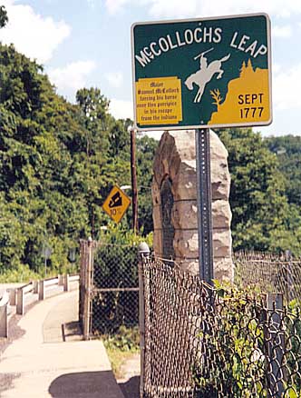

Picture on right - Highway sign commemorating this occasion,
just in front of original placard about this feat and the 10%
grade for US 40 on the wayward side of Wheeling Mountain.
Picture on left - Original placard about the
feat.

Back of Indian statue - I believe this statue ties into McCollochs leap. I found this to be the only safe place to take a photo of this statue (I wasn't about to stand in the middle of US 40).
Indian statue and McCollochs leap items are at the intersection of US 40 and McCollochs St.
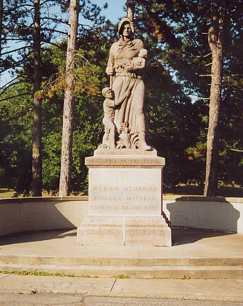
Madonna of the Trail -Wheeling Statue
Located just south of Wheeling Park on the far east side of Wheeling, this statue was part of a series placed along the National Old Trails Road (combination of the National Road and several other Western Auto Routes) during the 1920s by the National Society of the Daughters of the American Revolution (NSDAR).
For more about the Madonna of the Trail statues, you can go here.
Front Side

South Side


Above - Back side of statue
Left - North side of statue
Another View of this statue (and of the sign below) can be found here

This sign is located in front of the Wheeling 'Madonna of the Trail' Statue

Also nearby (of to the side of the other sign and 'Madonna')
is this sign commemorating the "birth" of West Virginia.
Looks like it was placed in a former right-of-way
for a street (look to your right).
If you wish to continue following National Road west into Ohio, via roadfan.com, continue on to this page

Head on view of the bridge going EB on I-470 in Ohio, descending down to the Ohio River
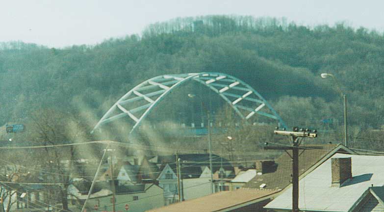
This picture was taken from the US 250 freeway SB.

From Wheeling's Waterfront Park.
Stub ends on the ramps to and from I-70 signal that some kind of highway was supposed to continue north from this interchange. When you look at the map at the bottom of this page, you'd see what these ramps were supposed to go to.
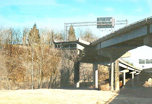
The ramp from I-70 WB to US 250 SB and stub end that would go north.
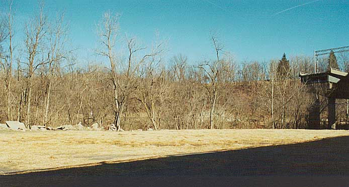
You'll have to use your imagination with this photo. The stub end from I-70 WB is on your far right. You can imagine what the continuation of this ramp would look like if it was built.

This stub end would have brought traffic going SB on the never completed freeway to EB I-70. The road in the foreground goes to McCollochs St. The bridge in the middle is the ramp from NB US 250 to I-70 EB.

The north end of the US 250 Expressway approaching I-70.
1962 Map of Wheeling
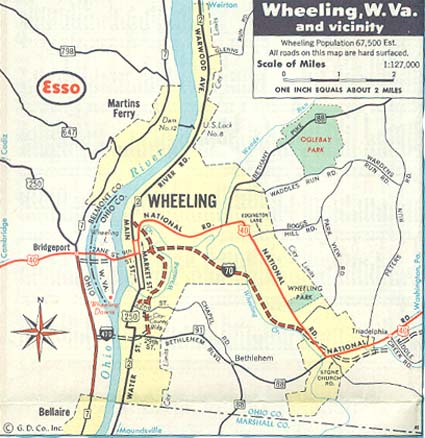
This map was included amongst the city inserts for Pennsylvania. Of importance in this map is that I-470 was planned not as a relief route for I-70 but as a smaller beltway around downtown Wheeling. Those stub end ramps in the photos above, those would of connected to a north-south bypass for WV 2 around Wheeling that would of followed McCollochs St.
Barb and John Bee (more photos of the Wheeling area bridges)
The National Road - A photo essay, West Virginia - Adam Prince
I-470 (Wheeling) - Kurumi
Belomar Regional Council - Metro Planning Agency for Wheeling
Page created on December 6, 2002/ last updated on July 3, 2006
Questions and Comments can be directed to Sandor Gulyas
Return to SE Ohio Regional Page or West Virginia Photos