Springfield
Landmarks and  through Western Ohio
Jump to: Springfield
Highways | Springfield Buildings | Snyder Park Riverwalk (seperate page) |
National Road Photos
through Western Ohio
Jump to: Springfield
Highways | Springfield Buildings | Snyder Park Riverwalk (seperate page) |
National Road Photos
Springfield Highways
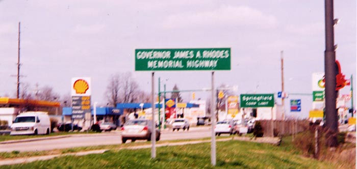 I'm sort of puzzled by this pronouncement. What Did
James Rhodes do for Springfield? He lived, grew up, and came to
power in Columbus, and we already have the James Rhodes Appalachan
Highway (Oh 32 from Cincinnati to Parkersburg, W.Va). So why another
highway?
I'm sort of puzzled by this pronouncement. What Did
James Rhodes do for Springfield? He lived, grew up, and came to
power in Columbus, and we already have the James Rhodes Appalachan
Highway (Oh 32 from Cincinnati to Parkersburg, W.Va). So why another
highway?
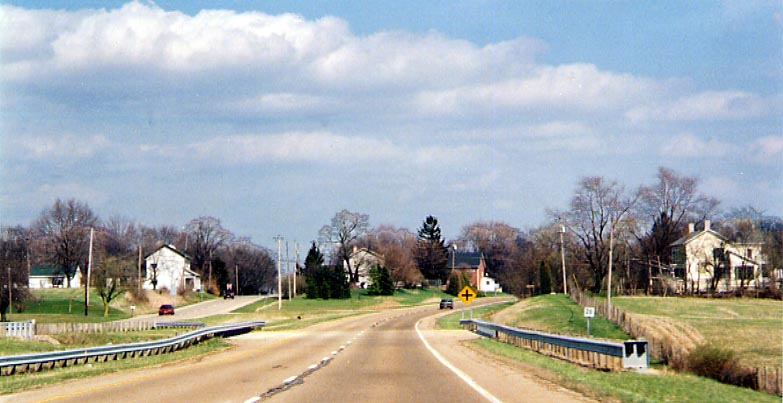
(Oh 72, between I-70 and the Springfield
Corp. Limit.)
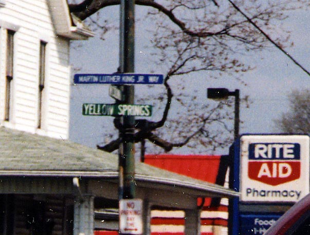 Springfield has it's Martin Luther King Jr named street.
It's just in conjunction with the already knowned Yellow Springs
Rd (and no I don't know any social or economic statistics concerning
the residents of this road as to leading to the MLK Jr. designation).
Springfield has it's Martin Luther King Jr named street.
It's just in conjunction with the already knowned Yellow Springs
Rd (and no I don't know any social or economic statistics concerning
the residents of this road as to leading to the MLK Jr. designation).
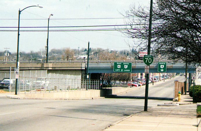 A fairly respectable looking Green Business Loop I-70
shield along US 40 EB just east of downtown Springfield. There
are several other Business route I-70 shields along US 40 EB on
the eastern fringe of Springfield, as well as a tri-color interstate
shield that mentions business I-70 on east as well. Ironicly,
I did not notice any I-70 business shields for westbound traffic
through Springfield.
Springfield Buildings
A fairly respectable looking Green Business Loop I-70
shield along US 40 EB just east of downtown Springfield. There
are several other Business route I-70 shields along US 40 EB on
the eastern fringe of Springfield, as well as a tri-color interstate
shield that mentions business I-70 on east as well. Ironicly,
I did not notice any I-70 business shields for westbound traffic
through Springfield.
Springfield Buildings
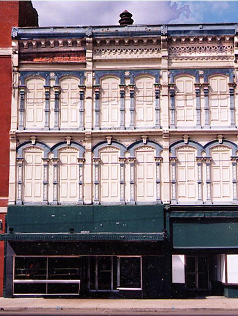
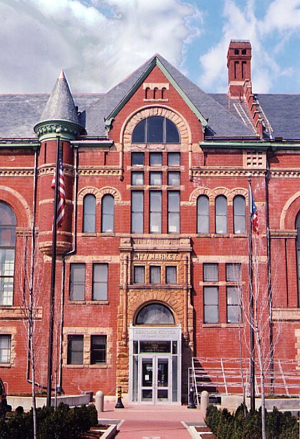 Meanwhile, back in Springfield. Springfield is working
on rehabing some of its historic structures. The building on the
left I found interesting due to the painting and facade. I wonder
if those were all doors above the (now abandoned) market. On the
right is the old City Market (and train station?) that is currently
the town's focus towards rehabing. I like how they've added 21st
Century security to the original 19th century doorway.
Meanwhile, back in Springfield. Springfield is working
on rehabing some of its historic structures. The building on the
left I found interesting due to the painting and facade. I wonder
if those were all doors above the (now abandoned) market. On the
right is the old City Market (and train station?) that is currently
the town's focus towards rehabing. I like how they've added 21st
Century security to the original 19th century doorway.
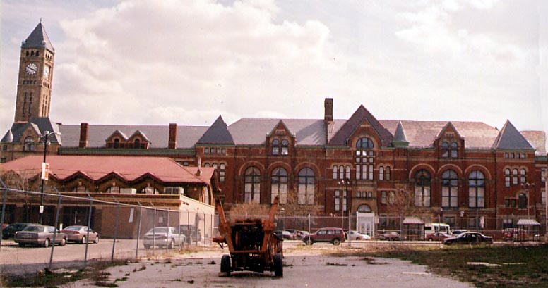 Here is a wide angle view at the back of the Springfield
City Market. It too has the 21st Century security entrance added
to it. I'm not certain what the future holds for this chained
off lot in the foreground.
Here is a wide angle view at the back of the Springfield
City Market. It too has the 21st Century security entrance added
to it. I'm not certain what the future holds for this chained
off lot in the foreground.
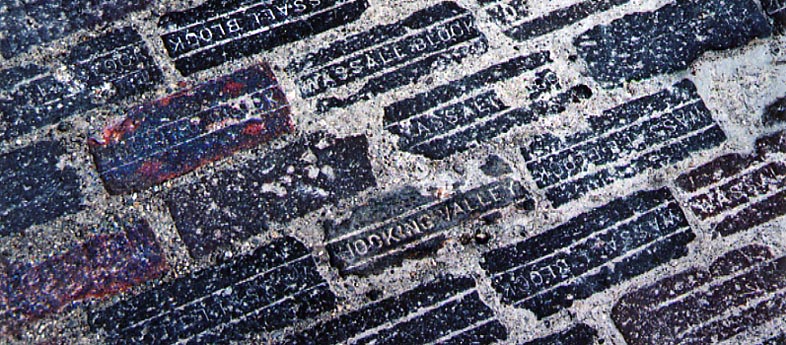 An old Hocking Valley brick (made in Nelsonville) surrounded
by Wassale Blocks (and where are they from?). Located on some
unknown alley north of the Springfield City Market.
An old Hocking Valley brick (made in Nelsonville) surrounded
by Wassale Blocks (and where are they from?). Located on some
unknown alley north of the Springfield City Market.
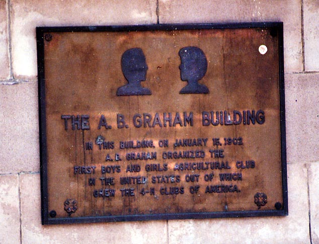 Springfield does play up the fact that 4-H was founded
in this city. They even named a building after the founder, A.B.
Graham.
Springfield does play up the fact that 4-H was founded
in this city. They even named a building after the founder, A.B.
Graham.
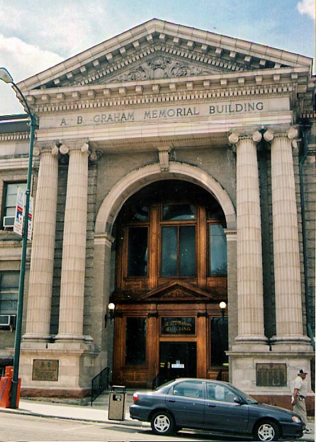
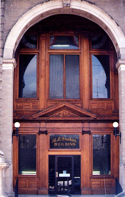 Here is two views of the enterance to the A.B. Graham
building. The photo on the left is of the entire front of the
building with the columns. The photo on the right focuses on the
enterence to the building. I wonder how old that (oak?) wood is?
The National Road
(going west to east)
Here is two views of the enterance to the A.B. Graham
building. The photo on the left is of the entire front of the
building with the columns. The photo on the right focuses on the
enterence to the building. I wonder how old that (oak?) wood is?
The National Road
(going west to east)
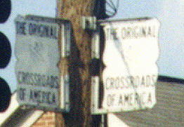 The Crossroads of America?! You decide.
At
the intersection of the Dixie Highway and the National Road (old
US 25 and US 40), north of Dayton. (Photo taken in July, 1999)
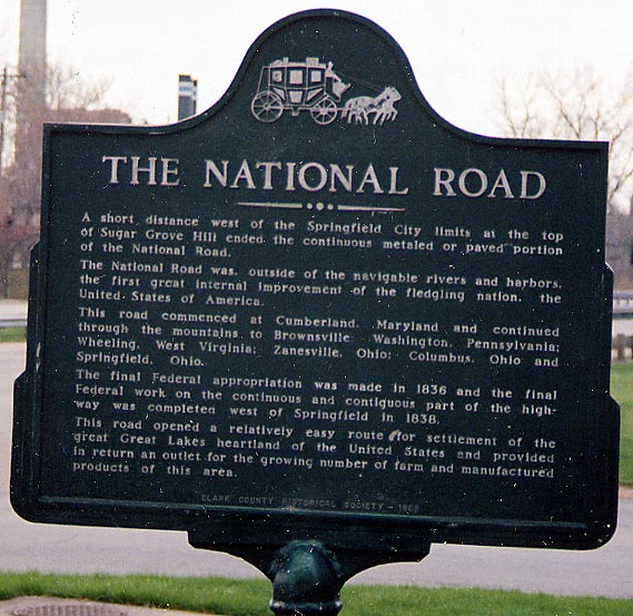 This plaque is Springfield's momento to the National
Rd (better known as US 40 today). This sign is located on the
western edge of Springfield near Buck Creek and Snyder Park on
the northside of the highway.
This plaque is Springfield's momento to the National
Rd (better known as US 40 today). This sign is located on the
western edge of Springfield near Buck Creek and Snyder Park on
the northside of the highway.
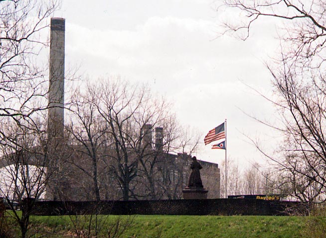 Just on the otherside of Buck Creek from Snyder Park
and the National Rd plaque (see above) is the Ohio Madonna of
the Trail Monument. Access to this monument is a bit tricky as
only WB traffic has access and even then you can easily miss the
turn off in the maze of turn offs and ramps (a cloverleaf interchange
with US 68 is just beyond this park as well). More photos of this
statue can be found here and here.
Just on the otherside of Buck Creek from Snyder Park
and the National Rd plaque (see above) is the Ohio Madonna of
the Trail Monument. Access to this monument is a bit tricky as
only WB traffic has access and even then you can easily miss the
turn off in the maze of turn offs and ramps (a cloverleaf interchange
with US 68 is just beyond this park as well). More photos of this
statue can be found here and here.
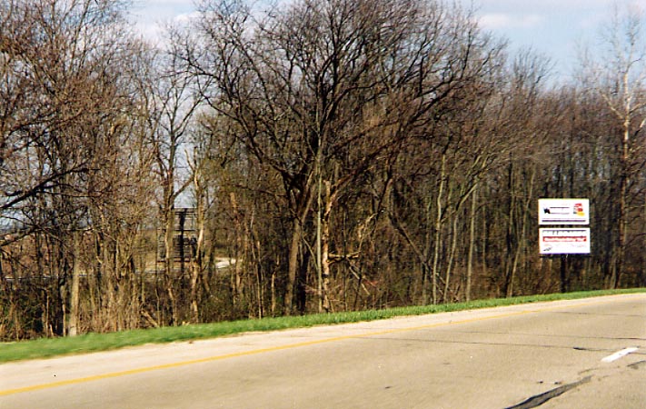 There are two locations along US 40 in eastern Clark
County where the highway splits. In both cases EB traffic was
routed around the community and WB kept the original road. This
grove of trees is for the first split, east of Springfield. Alas,
there is name for this area that I'm aware of.
There are two locations along US 40 in eastern Clark
County where the highway splits. In both cases EB traffic was
routed around the community and WB kept the original road. This
grove of trees is for the first split, east of Springfield. Alas,
there is name for this area that I'm aware of.
 The first traffic light permitted by ODOT? (read that
yellow placard in the middle carefully). Intersection of Old US
40 and Oh 54 in South Vienna.
The first traffic light permitted by ODOT? (read that
yellow placard in the middle carefully). Intersection of Old US
40 and Oh 54 in South Vienna.
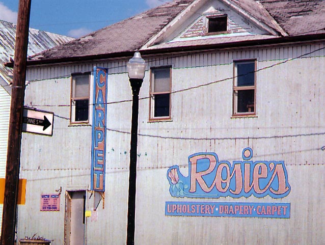 Bonnie's way and Rosie's Carpet. Where have all the
cowboys gone? (Intersection of Old US 40 & Oh 54 in South
Vienna)
Bonnie's way and Rosie's Carpet. Where have all the
cowboys gone? (Intersection of Old US 40 & Oh 54 in South
Vienna)
 Here is the second of the two split highways along
US 40 in Clark County. This time EB traffic bypasses the community
of Brighton (pop. 30)
If you are interested in viewing more National Road
photos on roadfan.com you can continue east
to Madison County
Here is the second of the two split highways along
US 40 in Clark County. This time EB traffic bypasses the community
of Brighton (pop. 30)
If you are interested in viewing more National Road
photos on roadfan.com you can continue east
to Madison County
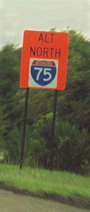
Detour route for I-75 via I-70 around Dayton, thus Alt I-75.
Along I-70 WB, between I-675 and I-75 (from a 2001 trip)
Links
All photos on this page were taken in April, 2004 unless
noted otherwise
Page created on April 30, 2004
Questions, comments, and submissions can be sent to Sandor
Gulyas
Return to the SW Ohio Regional Page