 (Left)
Map of the route from 1968, from the Dispatch
(Left)
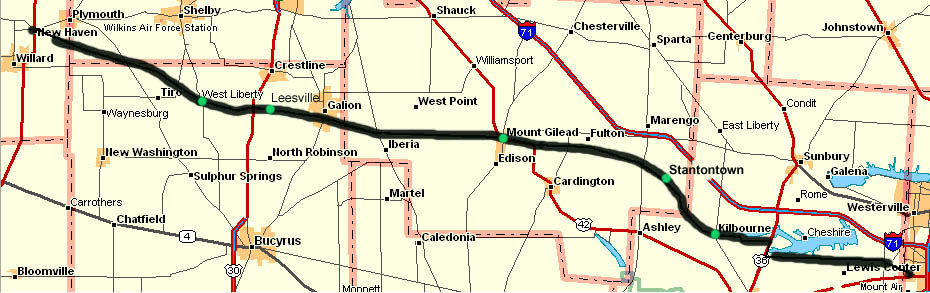
Map of the route from 1968, from the DispatchOld State Road was a federally-financed road built in Central Ohio soon after 1820. This article, which appeared in the Columbus Dispatch's Sunday Magazine in 1968, details the history of its planning and construction. It runs from modern US 23, just north of Worthington in Franklin County (north of Columbus), to modern US 224 at New Haven in Huron County (southwest of Norwalk). One can see the routing for Old State Road below, with points of interest and modern route designations (The only changes in the years has been US 30S becoming Ohio 309 and a reservoir along Alum Creek was created in Delaware County (Alum Creek Lake, county map showing location), causing Old State Road (Delaware CR 10 at this point) to be relocated.since the 1968 map was drawn).
(Left)
Map of the route from 1968, from the Dispatch
(Below) Map of the route from 2001 (Old State Rd is the thick black line, with the occasional green dots), from DeLorme Maps
This page created Monday, August 27, 2001/Last revised January 21, 2003
Questions or comments can be directed to Sandor Gulyas
Return to Central Ohio Regional Page