In the post-war era transportation was seen as important for both commerce and work. At first the federal government was letting the state governments worry about funding. At this time turnpikes/toll roads were seen as the local solution for express highway needs. In Louisiana, their first toll road proposal was the Acadian Thruway in 1953. Designed to go through the swamps of the Atchafalaya Basin while being far enough inland not to be efffect by coastal storms, it would provide a more direct route for those going from New Orleans west to Lafayette (while staying south of Baton Rouge).
The actual route for the Acadian Thruway was to be Lutcher
in the east to Lafayette in the west (both locations are approximate)
connecting US 61 and US 90. With the establishment of 1956 Highway
act (the last impatus to bring about our modern interstate system),
funding was designated for a route that was to be present day
Interstate 10 (from Lafayette to Baton Rouge to New Orleans).
After a last effort to get their highway included amongst the
interstate routes was declined, the Acadian Thurway went into
mothballs in 1957 (ironiclly the same year, Rand McNally showed
the Thruway on their Louisiana maps). Still, parts of that proposal
did get built by the Dept. of Transportation and Development.
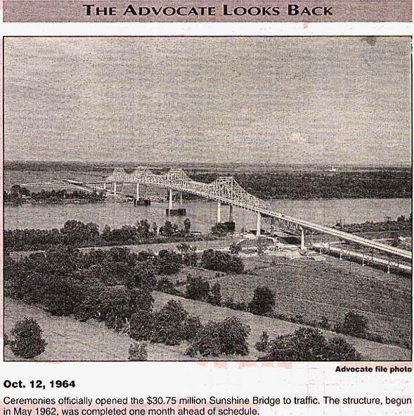
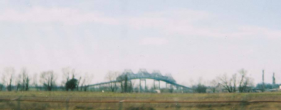
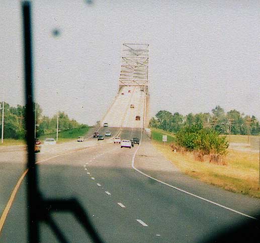
What was to be the Sunshine Bridge (1962-4) was constructed from
plans left over from the original Acadian Thruway project. The
1968 5 year transportation plan included 4 lane highways leading
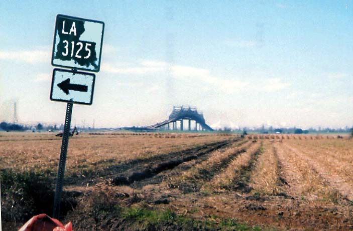
to the bridge from Lutcher (which became La 3125, a two lane road)
and Donaldsonville (the 4 lane La 3089). 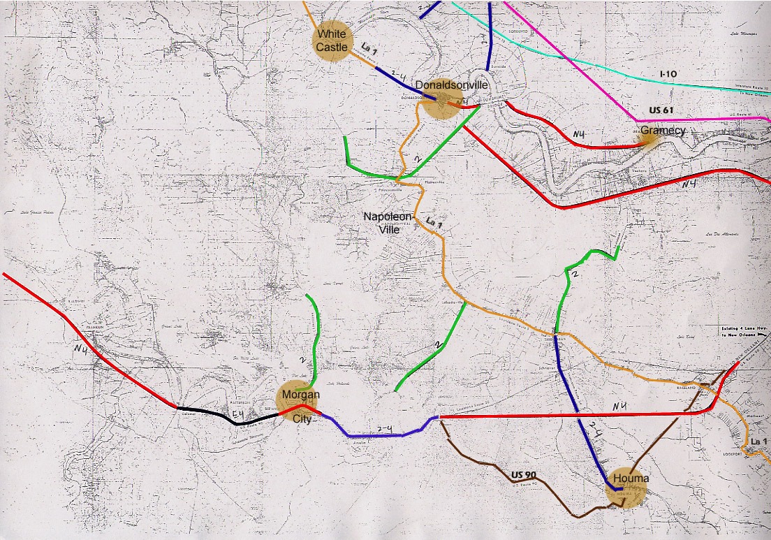 Color code system on this map: Red=
New 4 lane highway, blue= upgrade 2 lane to 4 lane highway, Green=
New 2 lane highway.
Color code system on this map: Red=
New 4 lane highway, blue= upgrade 2 lane to 4 lane highway, Green=
New 2 lane highway.
From Lousiana
5 year plan for highway construction (taken from the SCLTR Proposal)
between Lafayette, Baton Rouge, and New Orleans in the early 1970s.
In 1965, after the Sunshine bridge was completed, local interests were going to revive the Acadian Thurway proposal in a effort to bring more traffic to the (then Toll) bridge. However, in true Louisiana political fashion, the effort fell apart due to litagation as to which construction firm (the firm from the original contract in the 1950s or the firm that just completed the Sunshine Bridge in the 1960s) was in contract to build the highway and fears that toll revenues would never match the bonds used to fund the construction.
Shortly after the Acadian Thruway was put away for good, a
group calling themselves the South Central Louisiana Toll Road
Association put out a proposal in 1972 to build two toll roads
connecting Morgan City, Houma, and Donaldsonville. This group
would have completed US 90's evolution into a limited access facility
from Morgan City to Raceland (bypassing Houma to the north) and
build a connecting highway north to Donaldsonville and the Sunshine
Bridge. This project never made it beyond the report stage and
the Houma bypass for US 90 would not be completed for another
30 years. 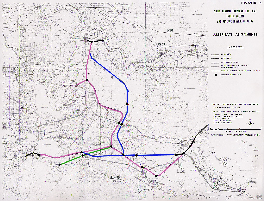 This
is the map of proposed routings for the SCLTR. Purple= Alternative
Route A, Blue= Alternative B, Green = Alternative Route A1, Grey=
Alternative routes that were rejected by the planners for this
group. For the Record, US 90 (soon to be I-49) was built following
Alt A1 and Alt B.
This
is the map of proposed routings for the SCLTR. Purple= Alternative
Route A, Blue= Alternative B, Green = Alternative Route A1, Grey=
Alternative routes that were rejected by the planners for this
group. For the Record, US 90 (soon to be I-49) was built following
Alt A1 and Alt B.
Source materials here:
South Central
Toll Road, published by Howard, Needles, Tammen, and Bergendoff
in 1972
Proposed five year highway construction
program, published the Louisiana Dept. of transportation and Development
in 1968
Baton Rouge (Morning) Advocate
Baton
Rouge Times-State
Unless noted otherwise, all photos,
on this page, were taken by me
Marty Blase's Louisiana Highway Page
John Weeks' Lower Mississippi River Bridges Page
I-49 from Lafayette to New Orleans (by Stephen Gantry)
Page created on January 11, 2006
Questions, comments, and submissions can be sent to Sandor Gulyas
Return to the Mississippi River Bridges