
The Short North actually falls inbetween Downtown Columbus (from I-670/Goodale Ave) and Ohio State campus along N. High St. It's the hip location in Columbus (and has been since the late 1980s) for shops, galleries, and restaurants/bars drawing from residents of Victorian and Italian Village, workers from the Central Business district, Battille Institute, and the Ohio State crowd (students, faculty, and admin). Talk about the right place at the right time.
This page covers signage (and other items) from Victorian Village, Italian Village, and the Short North as one group.
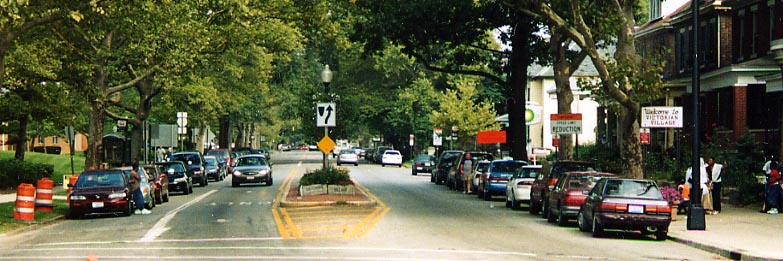
Victorian Village
A Traffic Circle traffic direction sign. Mind you, the circles were implimented on residential streets as traffic calming measure. This one is in Victorian Village (just south of the OSU campus) somewhere within King Ave, Neil Ave, I-670, and Oh 315
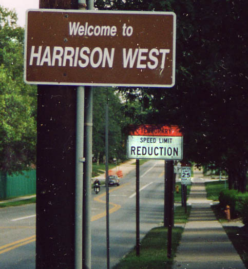
Another one of those "unofficial" subsets within Columbus. Harrison West was once part of Victorian Village, but broke away, probally over zoning requirements. Today, Harrison West is home mostly to Ohio State graduate students and employees to the Battille Institute.
Also of note, that Temporary Speed Limit Reduction sign has been on King Ave temporarily for the last 3 years....at least!
Along King Ave between Olentangy River Rd and Neil Ave. Photo from August, 2003.
The official gateway into Victorian Village (named such due to age of the housing in the area). You can see the Victorian Village sign on the right, what you can't really tell is that the words 'Victorian Village' are engraved into the stones in the median of the street (Neil Ave) as well. One could say Victorian Village rose out of the ashes of 'Flytown.' Neil Ave at Goodale Ave/I-670. Photo from September, 2003
(Stone) Post and moon? What it means I don't know. Along Neil Ave in Victorian Village (Photo taken in May, 2004)
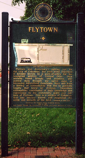
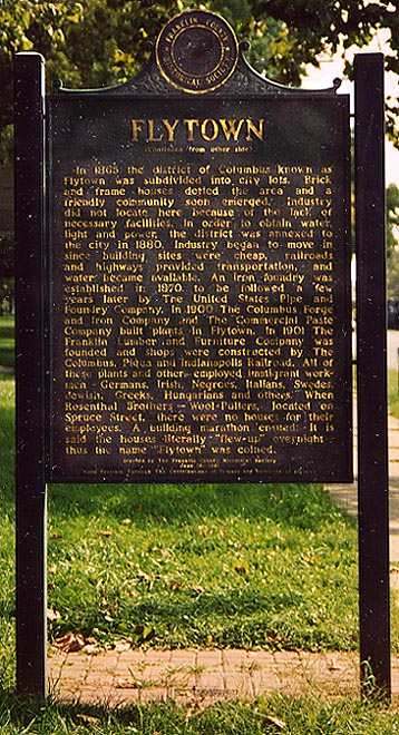
Don't let the niceities on this two-sided sign kid you "Flytown"
wasn't some neighborhood that anyone (outside of a couple of residents
maybe) should have warm memories of. Flytown was one of the more
"famous" slums in Columbus near the railyards before
Urban Renewal took it out in the 1950s & 60s. As one of my
Geography Professeurs at Ohio State loved to say. 'You had to
take out Flytown, bring in the freeway, then build Thurber Towers,
while having OSU and Batille near by, and you get present day
Victorian Village by way of unrelated but spatially related events.'
I should also note that Flytown was a little bit larger
than the sign claims. It extended a couple blocks north of Goodale
between Neil and Michigan Aves.
Sign along Goodale
Ave between Dennison and Park Sts, Photo from September, 2003
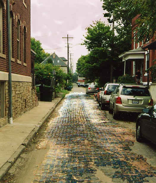
I found this brick alley just off Goodale Ave near Goodale Park. (Photo from September, 2003)
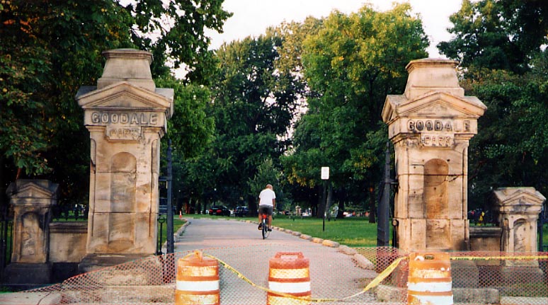
The "official" enterance to Goodale Park from Goodale Ave. The orange barrels (and snow fence) were leftover from the reconstruction of Goodale Ave with the I-670 reconstruction. Local citizens were afraid that ODOT would take a part of Goodale Park for the widening of I-670, but from what I could see nothing was taken from the park. Goodale Park is also one of the oldest parks in Columbus. Photo from September, 2003
The Arena District
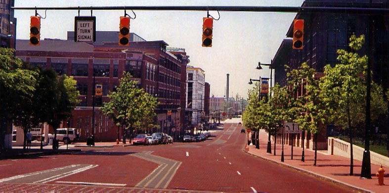
Nationwide Boulivard along Nationwide Arena isn't paved with red clay asphalt, but new red bricks (I wonder how long it took to lay them). Nationwide Blvd was extended west from High St to Neil Ave (then the name was overlayed existing Dublin Ave) with the construction of Nationwide Arena (yes Nationwide Insurance owned much of the land around here). Photo taken in May, 2004
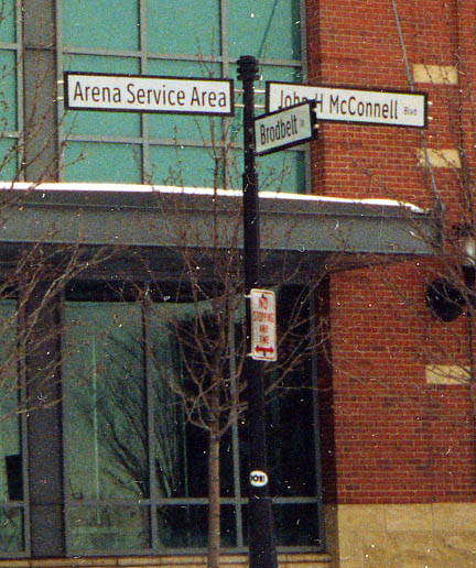
From out front of Nationwide Arena, the "arena district" gets to use roadsigns that are "non standard" for the rest of Columbus and Franklin County.
At the intersection of Brodbelt Ln and John McConnell Blvd near Nationwide Arena
(Photo from March, 2003)
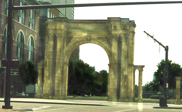
Also located in the "Arena District" is the last
remnant of Columbus' old Union Station. This arch originally stood
in front of High St., then was moved to Hickory and Front Sts
(behind the North Market) in the late 1970s, then was moved again
to it's present location in 1999/2000 at Nationwide and McConnell
Blvds.
Photo taken in September, 2003
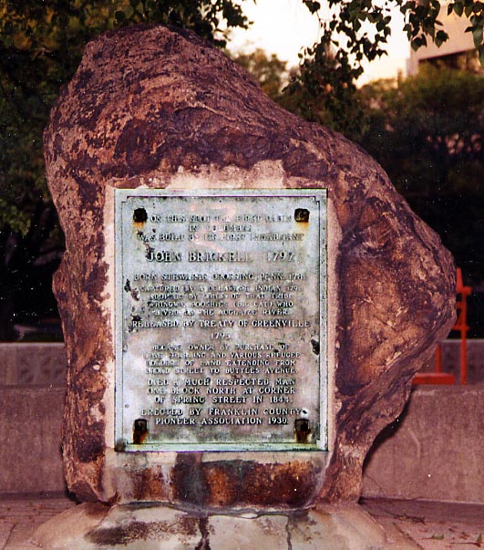
John Brickell was one of the first residents of Franklinton/Columbus from the turn of the 19th Century. Originally "kidnapped" by indians when he was a child, he was released to the "white world" in 1795 with the signing of the Treaty of Greenville. John came to live in here and supposedly where this rock stands was where the first cabin built in Columbus, by John Brickell stood.
This plaque goes on to say that John went on to own much of the land between present day Broad St to Buttles Ave (riverfront property?) before he passed away in 1844 at the corner of Spring St and Marconi Blvd. This monument was placed here in 1930.
This rock is located in the Alexander/Battelle Riverfront Park area between Long St and Marconi Blvd. Photo taken in May, 2004
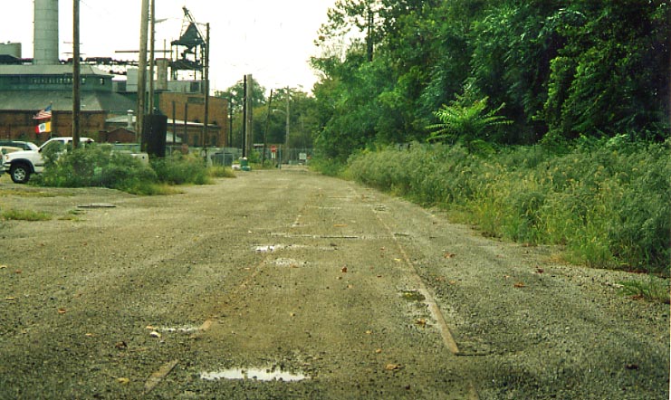
While I was searching out the remnants of Dublin Ave I found this rail remnant here near the City of Columbus impound lot. It was most likely part of the 3C & St. Louis Railroad many years ago. Photo taken in September, 2003
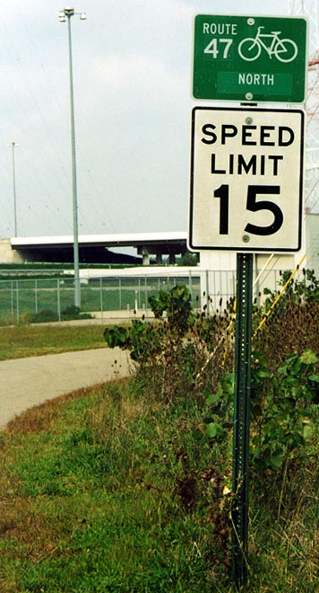
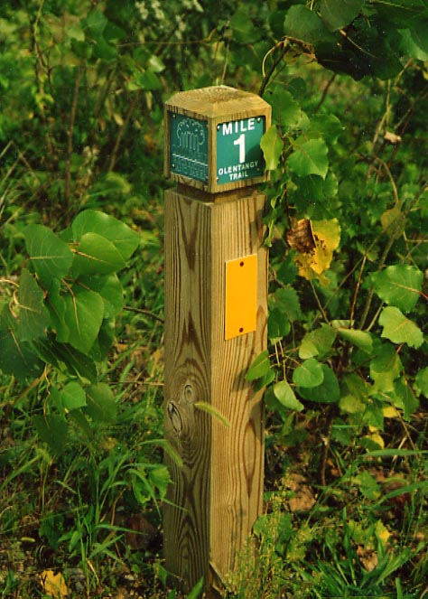
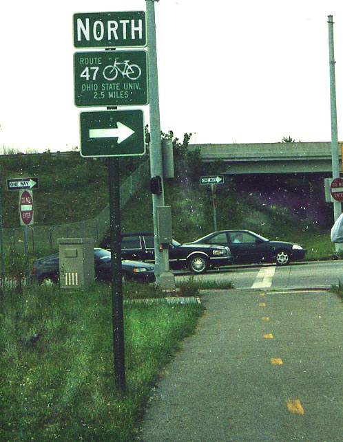
These three photos are all inter-related.
Ohio Dept. of Transportation not only has numbered routes for motor vehicles, but numbered routes for bicycles as well. The signage for the bike routes is as constant as for the motor routes we're all familiar with. The bike route signs are all white on green and they all have a bike to designate them.
The photo on the left shows a bike route sign with the next destination and the 'N' in north is taller than the rest of the letters. On Spring St. near Oh 315
The photo in the upper left has a bike route sign and a speed limit for the bikes along this trail (I wonder how much enforcement there is of the speed limit)
The photo in the upper right is trail blazer along this route by the Columbus Parks & Recreation Dept. Evidently, they placed these every so often along this trail (not necessarily every mile)
This site covers this particular trail
All 3 photos taken in September, 2003 and are all near the Oh 315/US 33/ I-670 junction
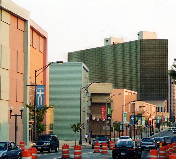
The pastel colored buildings on the left are all inter-connected
as the Columbus Convention Center. They are supposed to remind
people of boxcars (the old Columbus
Union train station used to stand here). The black building
behind the convention center is the Hyatt Regency Hotel.
Along
High St near Goodale Ave. Photo from September, 2003
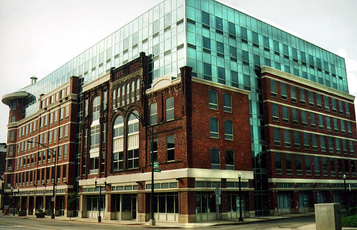
Here's an interesting take on historic preservation. This building
is now a Hampton Inn & Suites, and as you can see they kept
the front facades of the original buildings on this city block
and built behind them. This hotel is located across the street
from the Convention Center in the picture above.
Along
High St between Swan and Spruce Sts, Photo from September, 2003
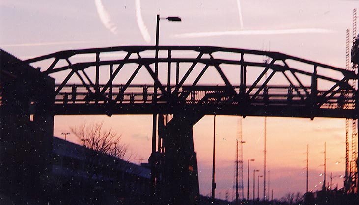
Near Front St. is this pedestrian bridge crossing some railroad tracks and Ohio Center Way connecting parts of the Arena District. (Photo taken in April, 2004)
Short North

Here's what the front of the west cap along High St (over I-670)
will look like (though I doubt the plywood and styrofoam will
be visable for all to see.
Photo from September,
2003
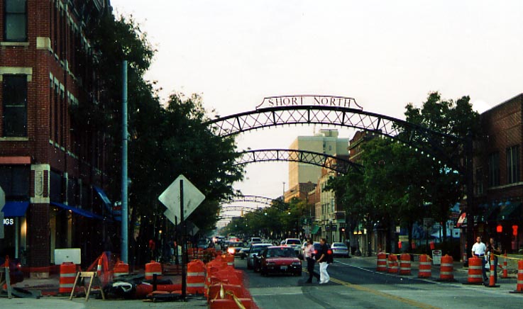
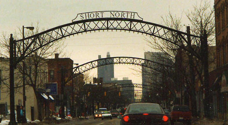
In 2001-2, the City of Columbus errected these arches along
High St through the Short North. If you look carefully, you'll
see lightbulbs hanging from them. It suspose to recreate old gas
arc lamps that used to line High St from downtown Columbus north
past Union (Rail)Station (now home to the convention center shown
a couple of photos above).
However, by the Spring
of 2003, the arch lamps had stopped working. The bulbs are either
not lighting up at all, or if they do it is as a multi-color visual
circus. They were not fixed as of September, 2003 when I-670 was
finished. Needless to say alot of people are unhappy about this
situation.
The top photo is the south enterance
for the Short North (from September, 2003), the bottom photo is
the north enterance of the Short North (from November, 2002)
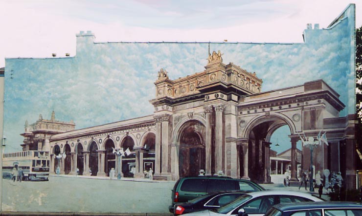
I've referenced Union
Station as a landmark in several of the photos above. One
Short North business owner allowed a murral deplecting the old
train station along the side of this building. This would be the
station facing out towards High St, from back in the day. The
only remnent of this station still standing is one of it's arches,
now standing near Nationwide Arena (on the Downtown
Columbus Photo Page).
This murral is located
in the first parking lot on the eastside of High St north of "The
Cap." Photo from September, 2003.
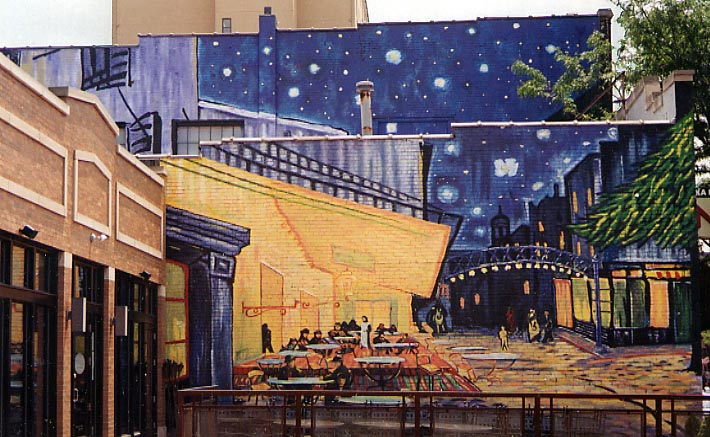
Speaking of murals, this was the winning choice from the Via Colori Celebration (I-670 Opening party) from September, 2003. This version now stands on the side of a restaurant on High St near Hubbard Ave. (Photo taken in May, 2004)
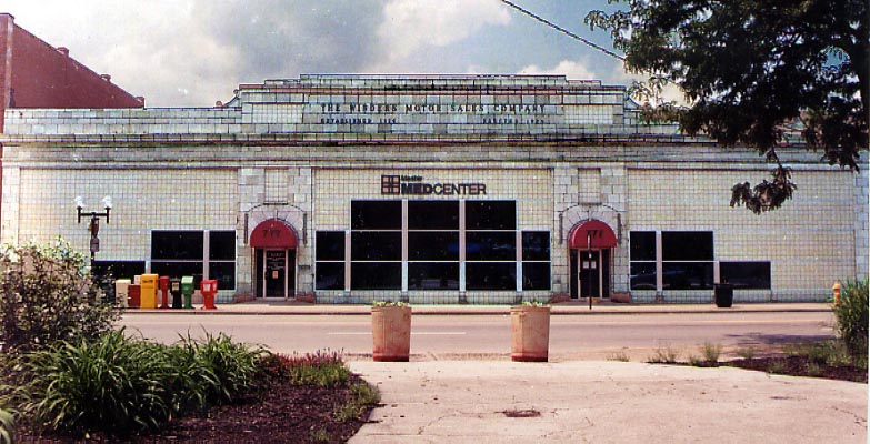
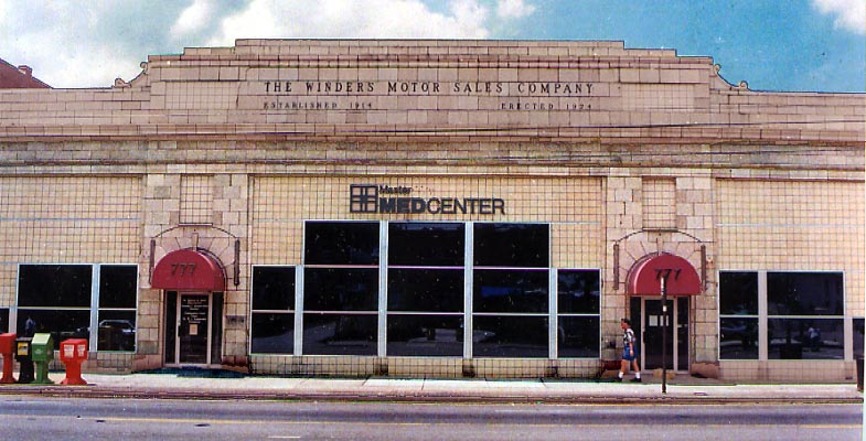
Nice recycling of this old automobile showroom. I like the color and cubism shape to the building. N. High St at Hubbard Ave.
Links
Short North Business Association
City Comfort Blog -page(s) covering the High St. cap
Short North Gazette - July story about the High St. cap
Page created on November 11, 2003/ Last updated on June 10, 2004
Questions, comments, and submissions can be sent to Sandor Gulyas
Return to the Columbus Virtual Roadtrip