
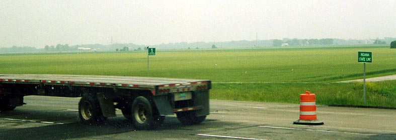
The subheading says we start at the Indiana border and we don't
lie. This would be Paulding Co. Rd 1 and yes the numbers get larger
as you head east.
(Photo from June, 2003)
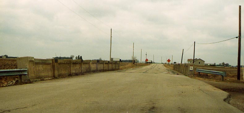
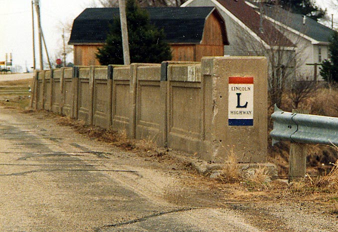
The bridge in the photo above and below is of a fading breed. You can see more clearly in the bottom photo the LHA blazer painted on the bridge abutments, both on the right side of the facing traffic. This bridge was left behind when the "New" US 30 expressway was routed near here and the old Lincoln Highway was ended just behind it. Photos taken in April, 2003
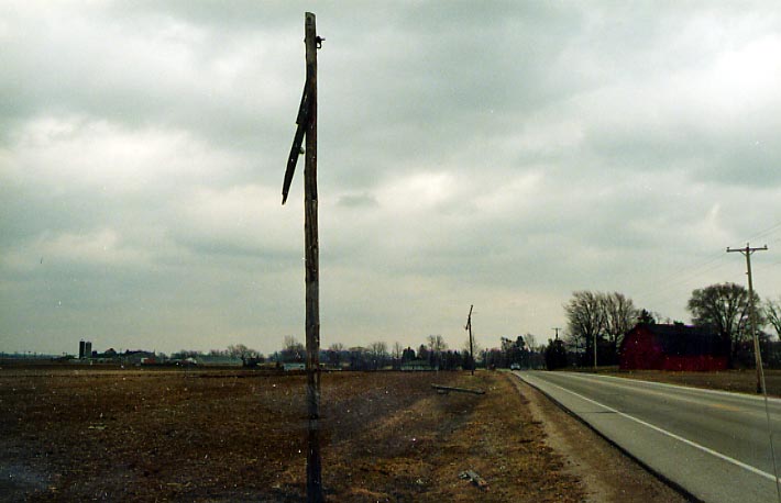
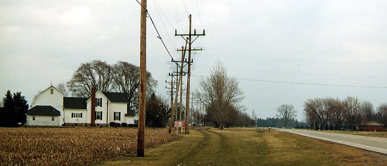
In case you wondered what a tornado could do, these poles along
the northside of the Lincoln Highway, west of Van Wert, were torn
about before the storm clipped the west side of Van Wert (I don't
know how the poles on the southside of the road were left standing,
if so). Photo from April, 2003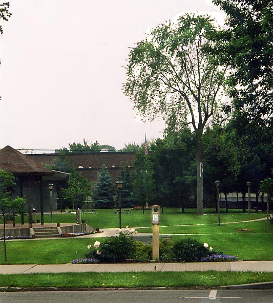
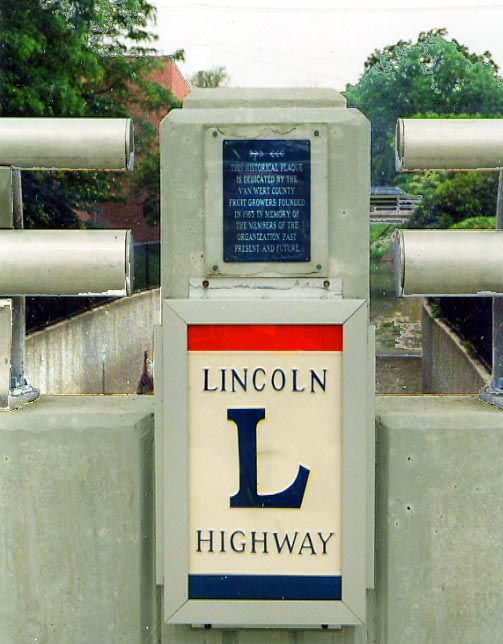
Left Photo: Lincoln Highway marker in Van Wert
Right
Photo: LHA marker and plaque on the Town Creek bridge (on
the northside of the bridge)
Both photos taken
in June, 2003
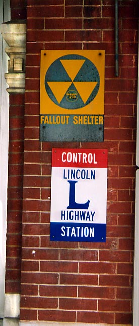
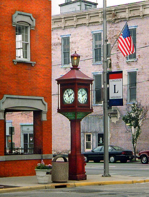
Left Photo: Control Station and a 200+ capacity fallout
shelter at the entrance to the Marsh Hotel in Van Wert
Center
Photo: Clock tower at the downtown point of Van Wert
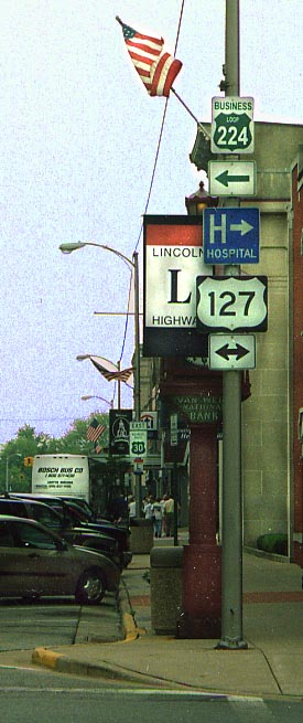
Right
Photo: Couple of Business Loop Routing signs for US 224 and
US 30 at US 127 in Downtown Van Wert
All 3 photos
taken in June, 2003
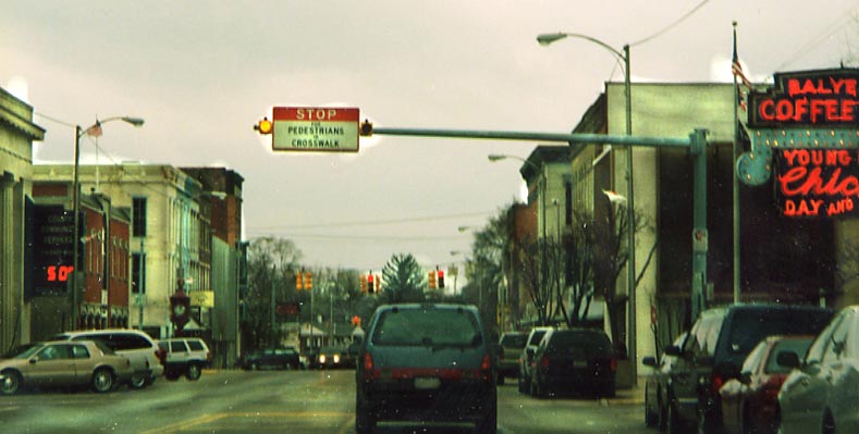
Overhead sign for crosswalk in downtown Van Wert. Photo taken in April, 2003
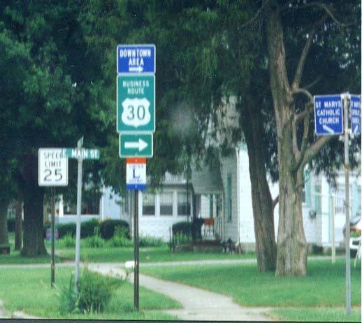
This is one version of the State of Ohio business route sign. Most often the signs are green on white (see Bucyrus example below). This one is white on green and is one sign instead putting the "business route" heading on a separate sign above the US 30 shield. This business route sign is posted in the city of Van Wert. Also note the Lincoln Highway marker in the sign assembly. (from 1999)
I am of the belief that the Lincoln Highway at one time went to the left along where the Electric poles are (you can even see ruts from the vehicles along that path). Maybe I am wrong the spacing there seems to indicate otherwise. Along Old Lincoln Highway between Van Wert and Delphos (photo from April, 2003).
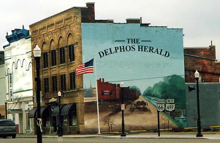
A nice mural concerning the old Miami and Erie Canal painted
on the side of a building in Delphos. Flag and the route shields
are real, not painted on the building.
Photo taken
in April, 2003
From Delphos, the original Lincoln Highway went SE to Lima
then east to Ada, Dunkirk, and Forest before reaching Upper Sandusky.
That routing now has it's own page of
photos I took.
Or you can continue to scroll
down following the 1921 route.
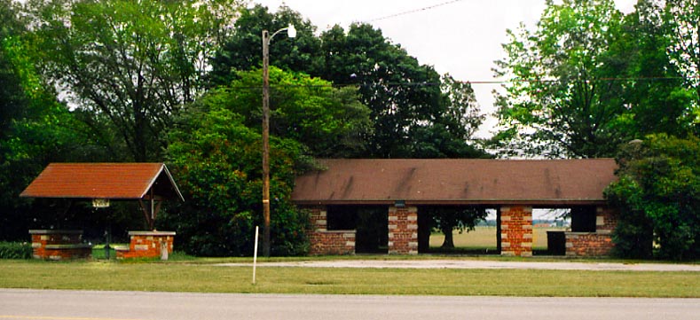
I believe this old rest stop is located near Leatherwood Creek between Gomer and Delphos. Obviously, it's no longer in use and in fact there are several private property signs on the buildings here.
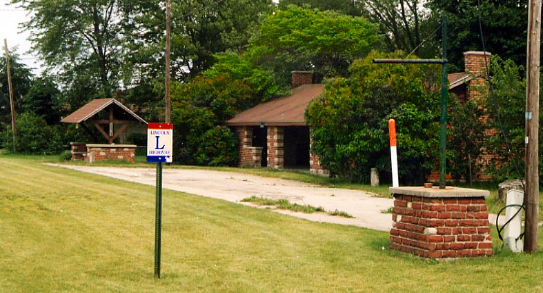
In this photo you can see a modern LHA blazer, the old sign holder for the rest stop, and the old parking lot (note the lack of access to it from the road.
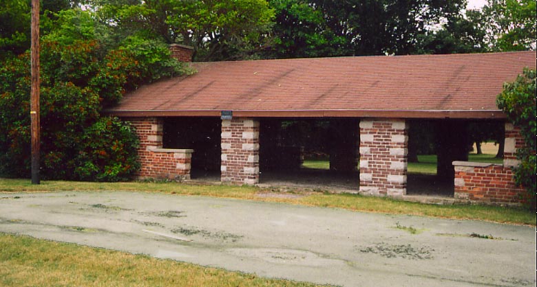
Don't try parking your car here and using the picnic shelter.
That black dot is a sign reminding visitors this is private property
now.
All the rest stop photos were taken in June,
2003.
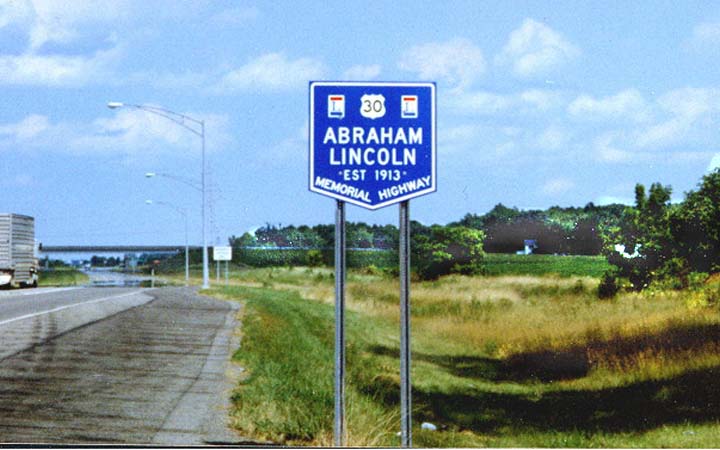
Obviously this is not the original highway here. This sign is at a rest area between Delphos and I-75; Brian Powell says that another sign exists at a rest area outside of Mansfield. There are many signs, similar to this one, for other divided highways in Ohio, usually in rest areas and occasionally at state lines. (from 1999)
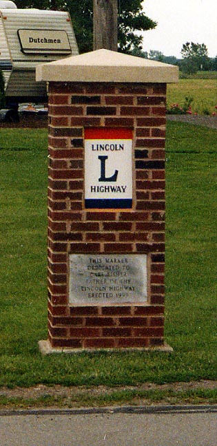
This brick LH pillar was a recent addition to the Lincoln Highway, constructed at the junction of the old Lincoln and Dixie Highways on the east side of Beaverdam by the Ohio Lincoln League in 1999. It is dedicated to Carl Fisher who orchestrated the creation of both the named highways that came through here. Photo taken in June, 2003.
Beaverdam
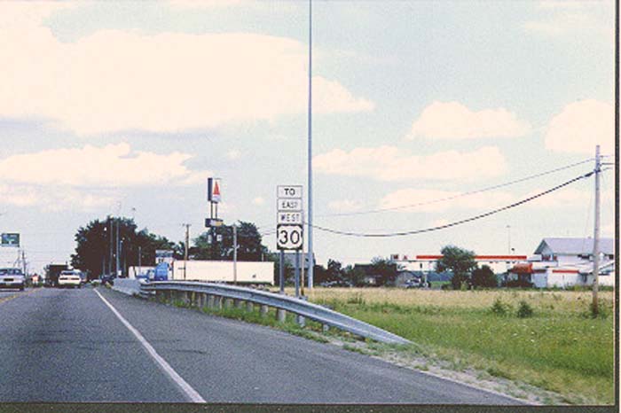
The first two photographs, below, were taken at the Interstate 75/U.S. 30 indirect connection near Beaverdam before the eastward extension of the US 30 freeway to Ohio 235 was opened in late 1999.
Chris Bessert, cartographer, maps of the refurbished US 30 interchange with Oh 696 and I-75
Map
of the new interchange for the extension
Map of
the US 30 extension
It's not often that one sees two banners with opposing directions above a route marker. At the Interstate 75 interchange looking east

The U.S. 30 freeway was originally planned to go under the bridge along old US 30/Lincoln Highway here when it was built (note southbound roadway built but unused, northbound roadway path graded only). This bridge was demolished when the area was reconfigured during the construction of the new eastward freeway extension.
Page created on January 25, 2003/last updated on June 27, 2006
Questions or comments can be directed to Sandor Gulyas
Return to the Ohio Lincoln Highway Page