
Crestline
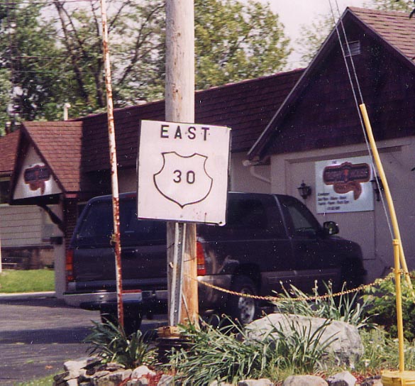
Talk about either no artistic ability or a total disregard of design. This is one of the worse federal highway replications I have ever seen. My suspicions is that the business owner, behind this sign, did the design work. Along old US 30 on the westside of Crestline (Photo taken in July, 2004)
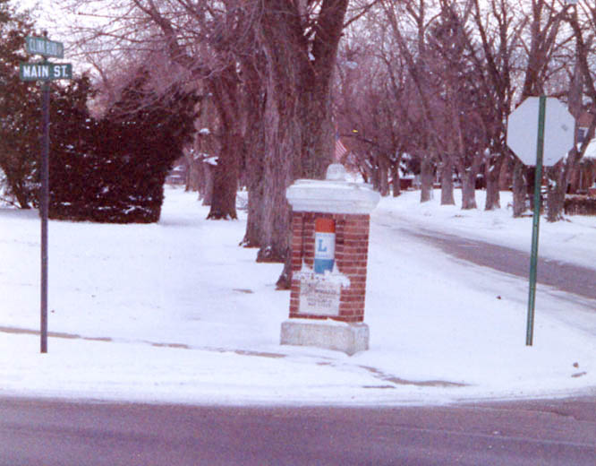
One of the Lincoln Highway Pedestal/markers that is found only in small area of Ohio. (Article about them here) This particular one is on the west edge of Crestline (Photo from December, 2000)
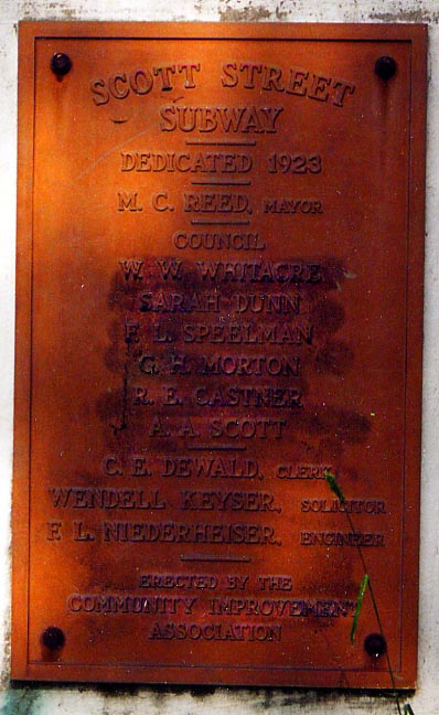
I have never seen an underpass referred to as a subway before. Then again, this might be one of the first grade separations between a roadway and rail line in Ohio. There were no trains going under this plaque, but over instead. (Photo taken in July, 2004)
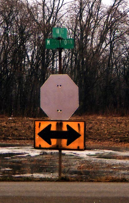
Hey Crawford County! Feel free to spend some money on some new signs at this intersection (Middletown Rd, just north of the soon-to-be new interchange between US 30 and Oh 61). Photo taken in December, 2004.
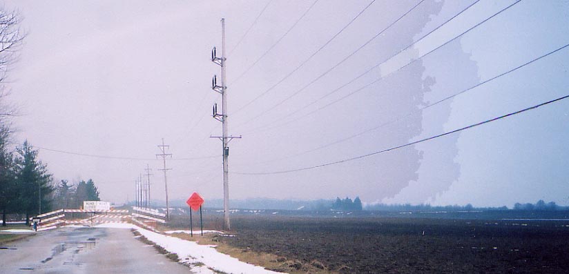
Looking south at the new US 30 and Oh 61 (The new US 30 expressway was not completed at the time of this photo). Photo taken in December, 2004
Ontario/Mansfield
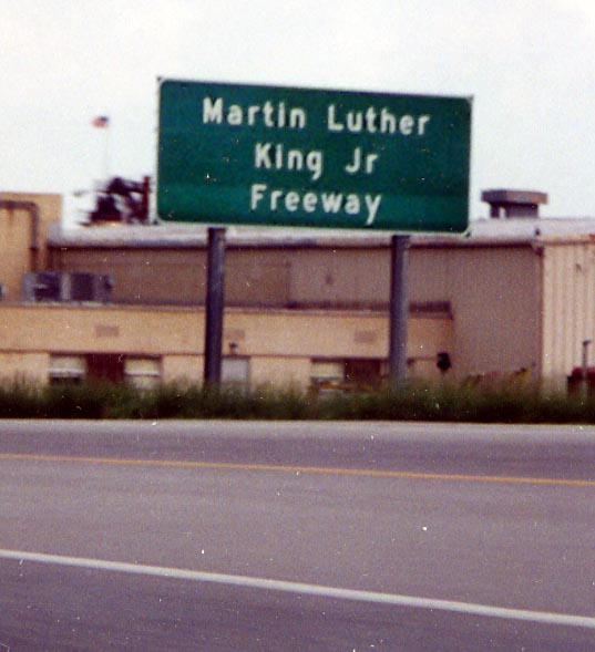
The US 30 expressway around Ontario and Mansfield is officially named after MLK. (Photo taken in June, 2004)
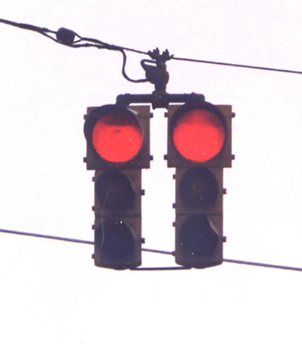
Greater Mansfield: Double traffic signal (either in Ontario or Mansfield proper from December, 2000)
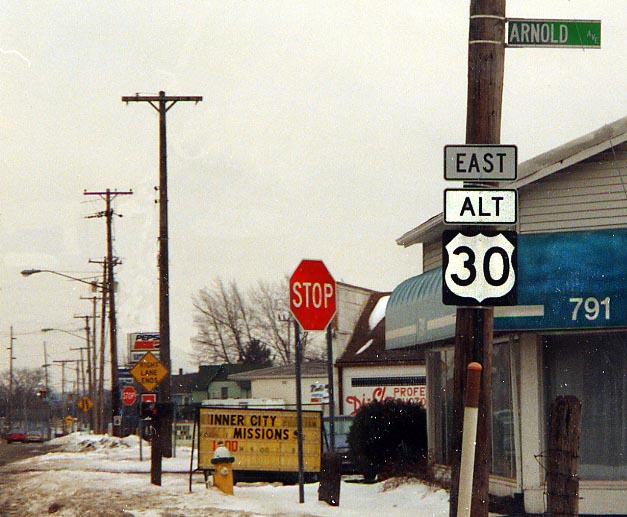
A new addition to the Ohio routes collection, (another) Alt
US 30. Actually this one is temporary as it's a detour route through
Mansfield while the US 30 expressway is reconstructed between
Oh 39 and US 42. Instead of using detour signs, Alt US 30 follows
Oh 39 from US 30 on the westside of Mansfield, through the town
all the way SE to I-71 then back north to US 30. Alt US 30 was
decommissioned after the Mansfield expressway was rebuilt in 2004.
There is a permanent Alt US 30 in Dalton, shown on
the Wayne County LH page.(Photo taken
in March, 2003)
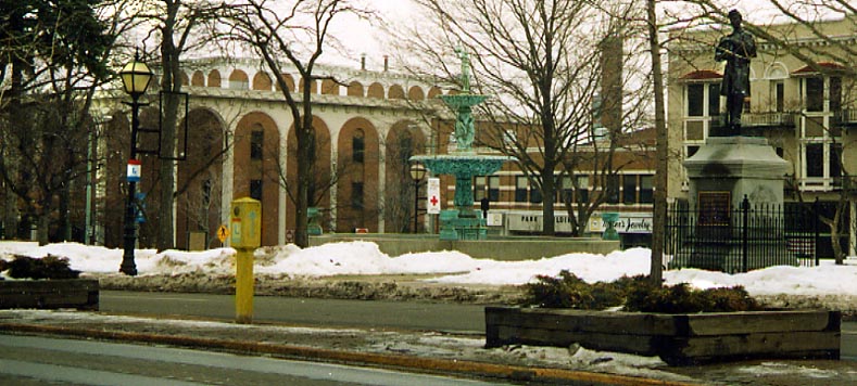
This particular Lincoln Highway marker has not always been located here in the median of Park Ave in Downtown Mansfield. It was moved to its current location by the Lincoln Highway Association (Both photos taken in March, 2003)
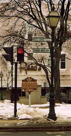
Left Photo - In an attempt to keep the Miss Ohio competition
in Mansfield, the city fathers redesignated Park Ave (the main
E-W thoroughfare) as Miss Ohio Blvd. No, the winner does NOT
get to parade herself along the street. In downtown Mansfield
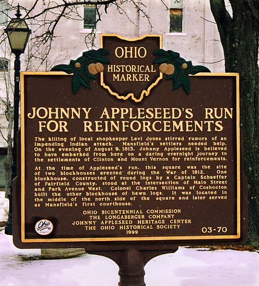
Right Photos - On the city square, the bicentennial
historical placard is about Johnny Appleseed, of all people. (Both
photos from March, 2003)
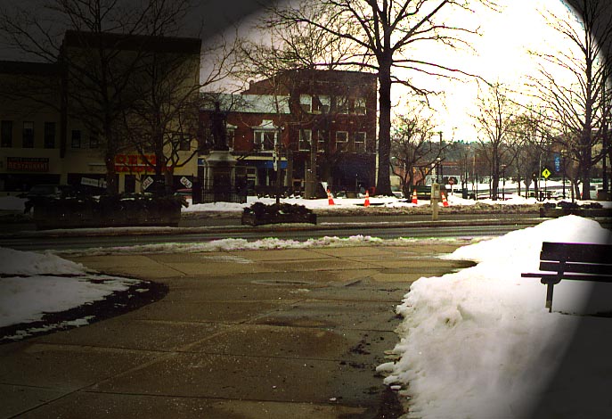
(More Mansfield
pictures can be found here)
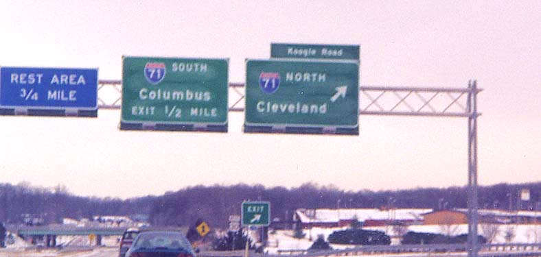
Go this way for I-71 North, and oh by the way, go this way to get to Koogle Rd as well (because the ramp goes to Koogle Rd, I-71 north ramp if further up the way). On US 30 Westbound approaching I-71 (map of interchange complex) Photo from December, 2000
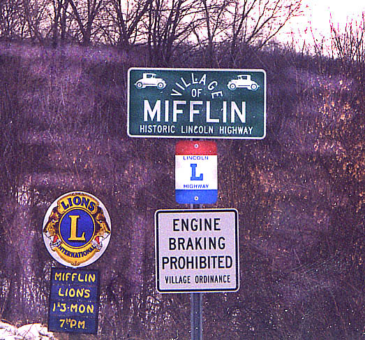
Some towns will take any means to promote themselves (I havn't seen any sign like this elsewhere in Ohio along the Lincoln Highway) (Photo from December, 2000)
Ashland Routing
From 1913-1928 the Lincoln Highway followed present day US 42 from Mansfield to Ashland and US 250 from Ashland to Wooster.
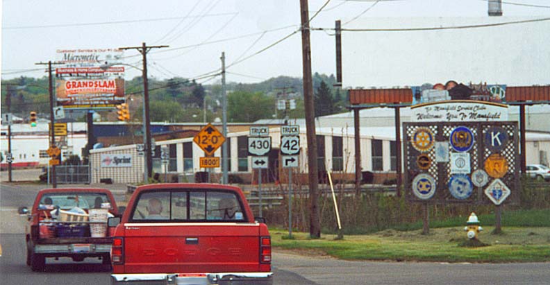
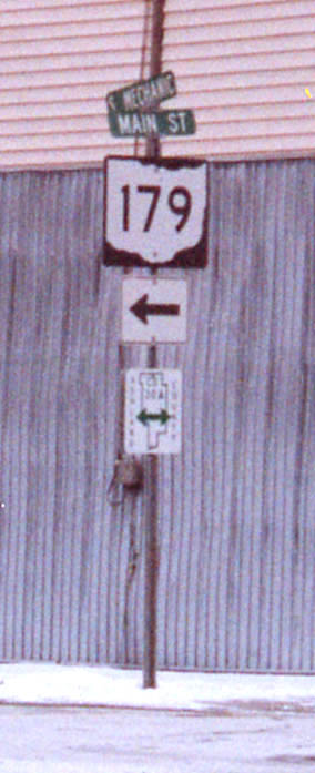
If your town/city/state can't afford to upgrade your bridges, a cost effective alternative is to route traffic elsewhere. In this case trucks are given their own route to avoid a low clearance railroad bridge on the east end of Mansfield. Along US 42 @ Oh 39 in Mansfield.
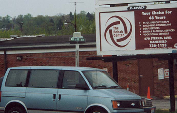
Street name = length? An original idea or too short for something really creative? Along US 42 in NE Mansfield
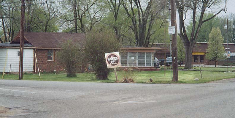
Not your regular white on green highway sign to direct traffic to your locality. It's nonstandard design could be in part because Madison City "not existing" in "official" eyes. Along US 42 north of US 30
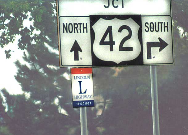
Dated LH Marker This Lincoln Highway marker has the date this road was used as the Lincoln Highway underneath it. A new aspect that the Ohio Lincoln League is using to mark all the various routings of the Lincoln Highway in Ohio. Business Route(?) US 250 near US 42, east of Ashland (from 2002)
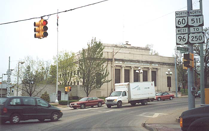
Downtown Ashland The Lincoln Highway would turn left (onto the former routing of US 42 in Ashland) at the courthouse. US 250 would turn right (as the signs show), if it was still routed through Ashland. (from 2002)
Hayesville: Special Ashland County road signs for what was US 30 before the bypass (from December, 2000)
Page created on February 14, 2004/ last updated on May 18, 2005
Questions, comments, and submissions can be sent to Sandor Gulyas
Go west to Lincoln Highway in Crawford County | Go east to Lincoln Highway in Wayne County | Return to Ohio Lincoln Highway Page