
The I-70/US 33/Oh 104 junction (terraserver map of area)
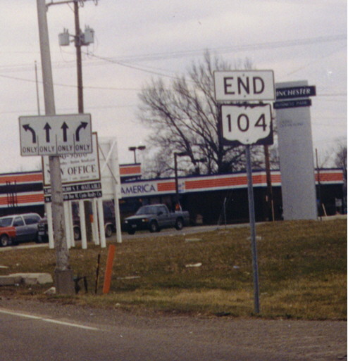
These two Ohio 104 sign assemblies have banners designed for the larger marker used on freeways. The first picture was taken at Ohio 104's terminus at U.S. 33 (northern terminus on a larger scale, eastern terminus on a smaller scale -- Ohio 104 is shaped like a flipped "L"). The second picture was taken on an exit ramp from U.S. 33 Eastbound (Southbound on the national scale) . The Ohio 104 assembly was added here when the east-west freeway portion of Ohio 104 was completed.
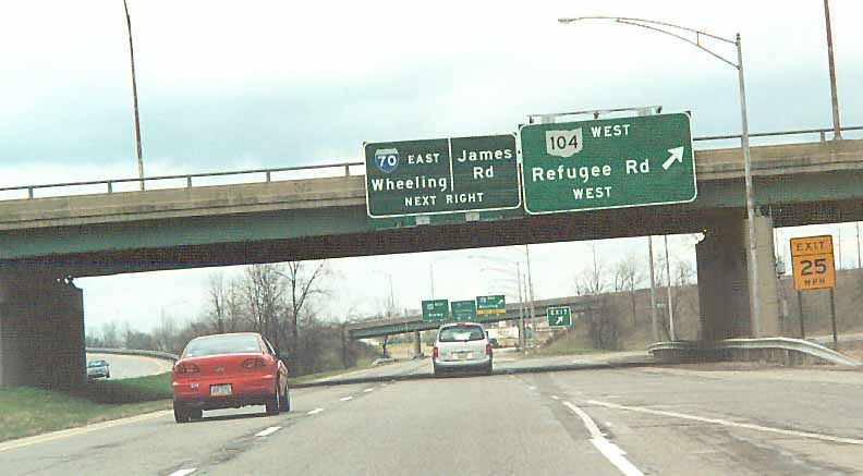
The only mention of James Rd on US 33 NB (or WB) amongest the I-70/OH 104 interchanges. Instead of James Rd, the BGSs say I-70 Wheeling. BGS assembly is placed on the Refugee Rd (104) overpass.
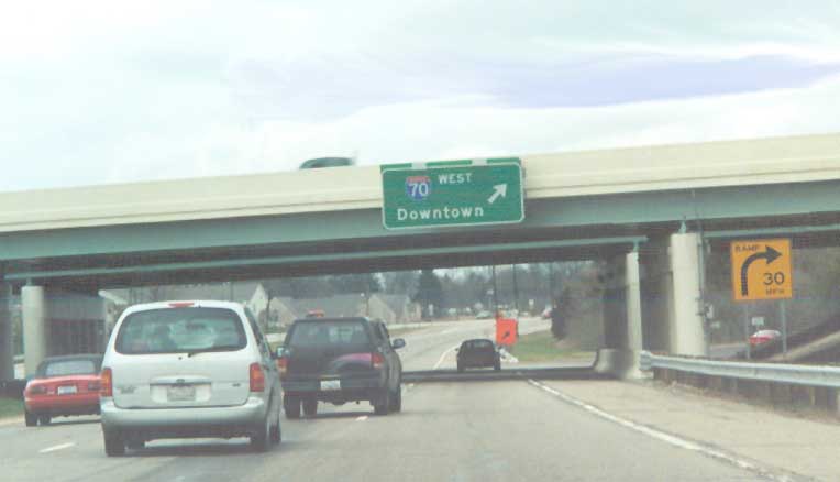
Assuming you know you're approaching Columbus, then I-70 west will take you downtown. US 33 W (or N) B at I-70
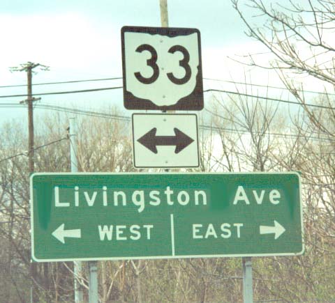
Now that ODOT mentions US 33 on the BGSs for Livingston Ave (for WB I-70), they downgraded 33 to an Ohio route when you reach Livingston Ave. [by mistake].
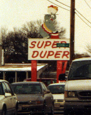
An old sign that still stands. The Super Duper Elephant was a long time Columbus tradition that has slowly fading into the past. Fortunetly, I found this one still standing along James Rd (between Livingston Ave and Main St) back in January of 2003
Bexley Photos
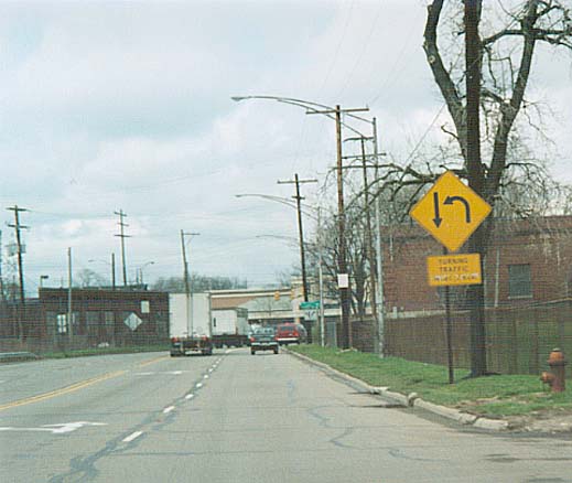
You can make U-turn (or is it a hard left) from NB Alum Creek Dr to the ramp for I-70 WB south of Main St, just west of Bexley, from the SB side. Why illustrating that SB traffic doesn't stop, I don't know
Small Green Sign alerting WB traffic on E. Main St that they can reach I-70 by turning left. (Photo digitally altered) Intersection of Main St (US 33 and Temp US 40 in previous lives) and Alum Creek Dr.
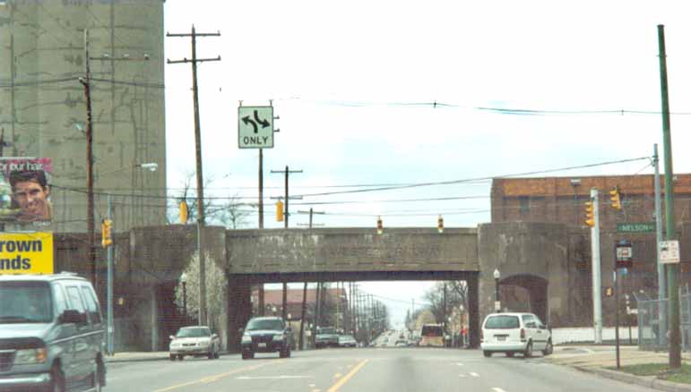
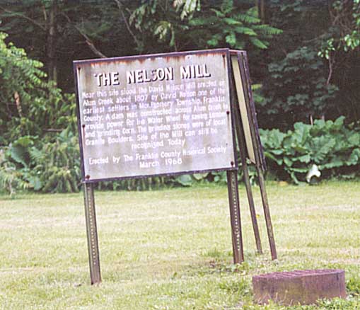
Old concrete bridge that promotes its original owner (Norfolk and Western RR). Micah Smith wrote to correct me that the railline is west of the Bexley border (Alum Creek is the west border for Bexley, suburb of Columbus). E Main St at Nelson Rd.
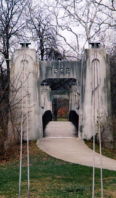
The second oldest suspension bridge in Ohio? This 1922 structure appears to have always been a pedestrian walkway over Alum Creek between Franklin and Wolfe Parks near Bexley.
Photo from December, 2003
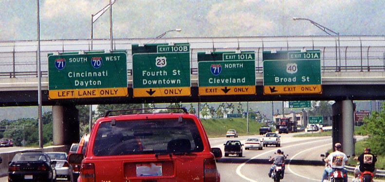
I guess ODOT wasn't kidding about reducing I-70 to one lane
through the east split. Of interest here with the new signs, Broad
St (which is actually an exit along I-71) gets a mention (and
it's own lane) along I-70 WB. The control city for US 23 is "Downtown."
Hope you know you're in Columbus by now.
Photo
from May, 2004
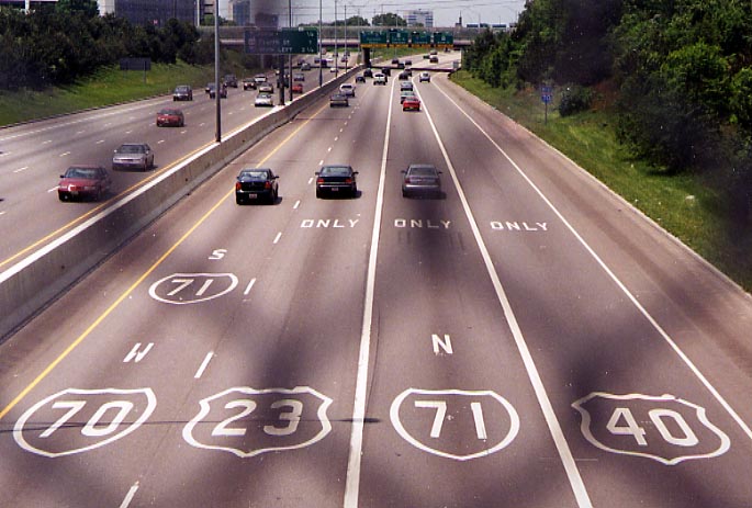
ODOT is trying painting the route(s) on the pavement of I-70 going through Columbus to see if it helps reduce driver confusion (congestion, accidents?) This instance is I-70 WB aproaching the "East Split" with I-71, looking down from the Ohio Ave overpass (Photo taken in May, 2004)
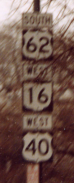
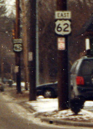
Like the 37/36 pairing in Sunbury (see Road Photos of Central Ohio main page), this sign assembly has its markers in an unconventional order. The marker for U.S. 40, a transcontinental highway, is under one for a shorter, higher-numbered U.S. route, and even under one for a state route. (Also note that U.S. 62 is signed "SOUTH" and not "WEST" here.) Along E Broad St between Bexley and I-71
Reynoldsburg
Page created on November 8, 2002, last updated on May 16, 2005
Questions, comments, and submissions can be directed to Sandor Gulyas
Return to Columbus Virtual Roadtrip