Submitted Photos - Matt Walcoff
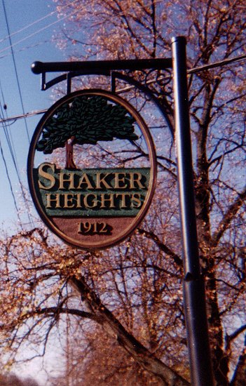
Shaker Heights was known as a "model suburb" and truly has some of the most beautiful neighborhoods in the region. Like many area communities, the city has replaced its welcome signs in recent years with fancy ones like this.
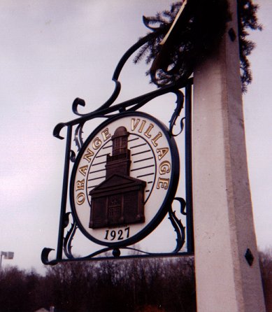
Another new welcome sign, installed in 2001. The building on the sign is the village hall, built a few years ago.
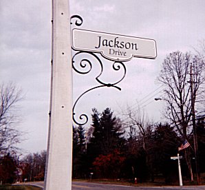
Orange recently replaced all its street signs with these fancy ones with wrought-iron decoration. Needless to say, Orange is a rather wealthy suburb.
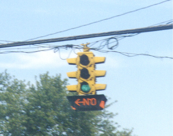
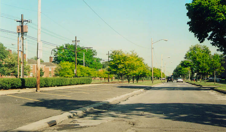
This signal is used when there is a continuous movement at
a signalized intersection (that is, one that never gets a red
light). These are common in Michigan, but this is the only one
I've seen in Ohio, although former Cleveland and North Olmsted
resident Brian
LeBlanc reports that there is also one on eastbound Lorain
Road (Ohio 10) directing traffic onto Brookpark Road (Ohio 17)
in North Olmsted. Sandor also interjects that there are several
of these in Columbus as well, just unphotographed.
On
Cedar Road Eastbound at Overlook Road, Harcourt Drive, and Euclid
Heights Boulevard
Many years ago standard traffic lights were made with "STOP"
and "GO" indications on the corresponding lenses. Some
almost survived into the 21st Century, like this one at Cedar
and Coventry Roads in Cleveland Heights (although this one only
has the indication on the green lens). Also pictured is another
neon turn restriction sign (see above). Note: This photo was taken
on August 31, 1999; this signal was removed later as part of a
signal upgrade project.
On Cedar Road Eastbound
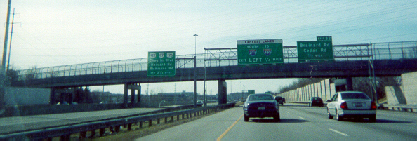
Here is a section of I-271 in the local/express configuration.
The Express Lanes were started in 1992, and completed south to
Chagrin Blvd. (US 422/SR 87) by 1995 and to the I-480/US 422 interchange
in 1998. See also this page.
I-271 Southbound approaching Brainard Road/Cedar
Road exit, which is
to be reconstructed/reconfigured slightly in 2004
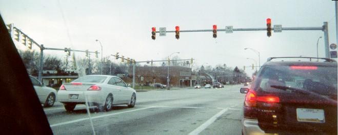
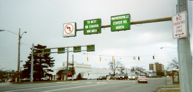
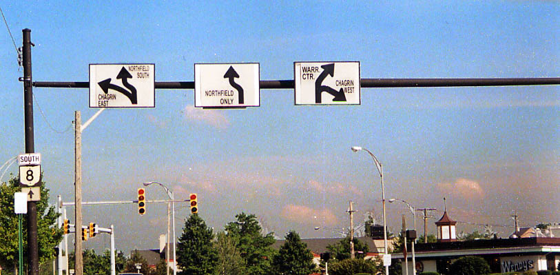
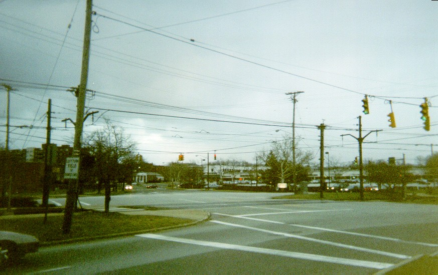
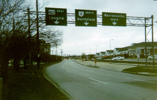
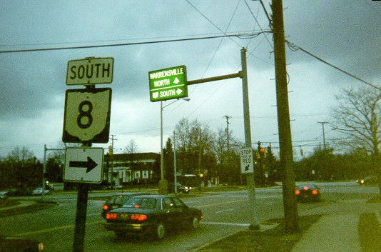
The Chagrin Boulevard/Van Aken Boulevard/Northfield Road/Warrensville Center Road intersection (Jct. US 422/Ohio 8) in Shaker Heights
Because of the large traffic volume through this six-way intersection (map -- US 422 follows east-west Chagrin and Ohio 8 turns from Northfield Northwestbound to Chagrin Westbound), there is interesting signage.
Chagrin (US 422) Westbound
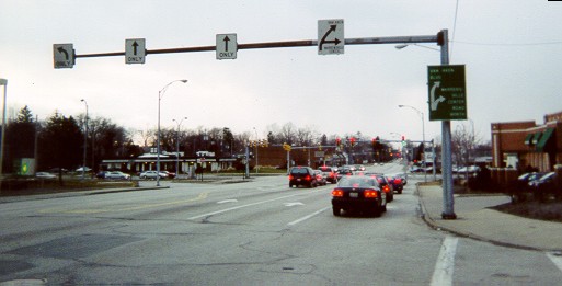
Wide
view
Closer
view - The green arrows are, top to bottom, up-right and right.
Note that the red is still lit.
At
the intersection - The "NO TURNS" sign only applies
to the signal just to the left of it, although that's not readily
apparent.
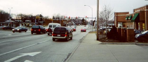
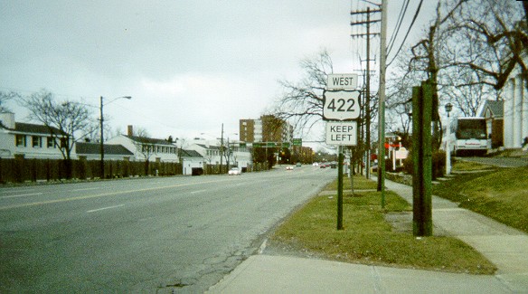
Warrensville Center Rd (North then South)
Northward
from the intersection - Van Aken is on the left side of the photo.
Note the back-lit overhead guide signs.
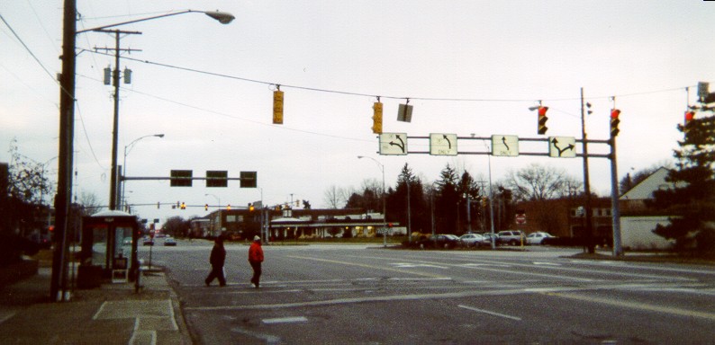
North
just beyond the intersection
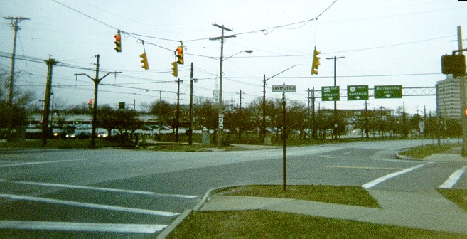
Because there is no
left turn onto Van Aken or Chagrin Westbound (US 422/Ohio 8) from
Warrensville Center Northbound, drivers are instructed to follow
Farnsleigh Road (in the distance) Westbound to each. Ironically,
by the time Farnsleigh meets Chagrin, it's going southeast. Note
the unusual US 422 shield.
Warrensville
Center Southbound - Barely visible on the leftmost two back-lit
turn lane signs are route shields next to the arrows.
Van Aken Blvd
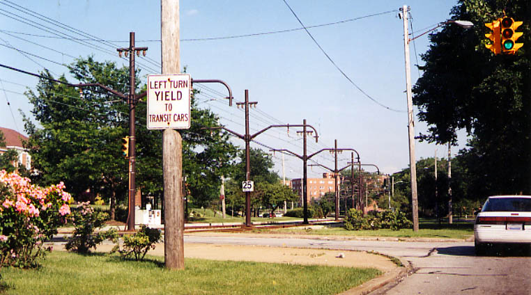
These two photos along Van Aken are closer to Shaker Square than they are to the junction with Chagrin, Warrensville, and Northfield (from June, 2004)
Van Aken Southeastbound - The signs in this direction are not back-lit but still have odd shaped arrows.
The
Van Aken/Farnsleigh intersection looking east.
The GCRTA has a track down the median of Van Aken. Note the separate traffic signal for the track.
The red lights are flashing, as are the ones facing the other direction toward the track. This is to avoid stopped traffic. The rest of Farnsleigh's signals are solid red. This set-up is found throughout the area as both Van Aken and nearby Shaker Boulevard (for the most part Ohio 87) have tracks in the median. The sign on the left says "LEFT TURN/YIELD/TO/TRANSIT CARS".
Looking
southeast on Van Aken - The more standard overhead green signs
indicate not control cities but street names. Just to the left
is the GCRTA Blue Line eastern terminal.
Approaching
on Farnsleigh Northeastbound
This
is on Farnsleigh Road just northeast of the Chagrin/Van Aken/Northfield/Warrensville
Center intersection.
Same
location, just a closer view
Page created on December 26, 2002/Last revised May 16, 2005
Questions and comments can be sent to Sandor Gulyas or Marc Fannin
Return to Cleveland Virtual Roadtrip