Due to the amount of photos I've taken of I-670 and it's related projects here in Columbus (and to help those with slow internet connections to not get bogged down), I have created this page to deal exclusively with photos related to the reconstruction of I-670 from Oh 315 to US 23. This too could be subject to change.
I-670 at Spring-Sandusky interchange, April 2002
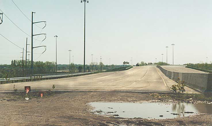
Looking at the EB lanes from where the pavement ends. Ramp from 315 NB is on near right, the back of the BGS for Neil Ave. exit (EB) is in the distance.
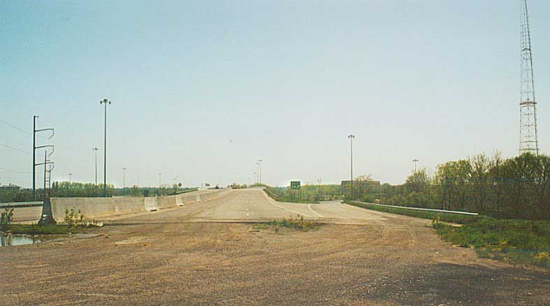
Looking at the WB lanes. The ramp on the immediate right is to SB 315. Tower in the distance belongs to WBNS television.
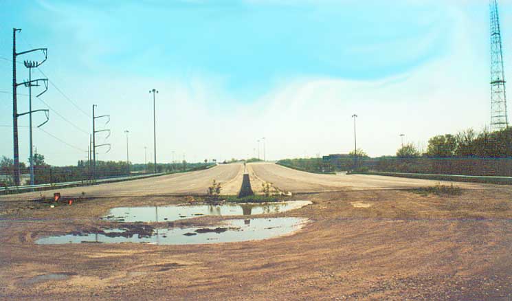
Middle view. Has sort of a Duck Amuck quality to it with the sudden end of the freeway.
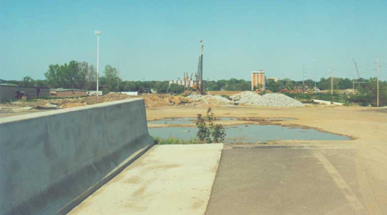
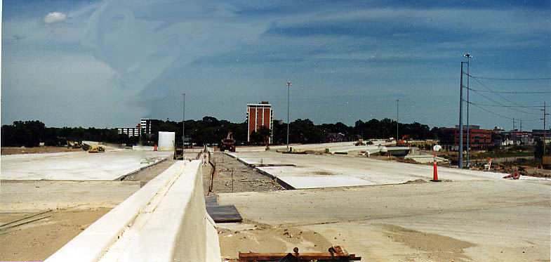
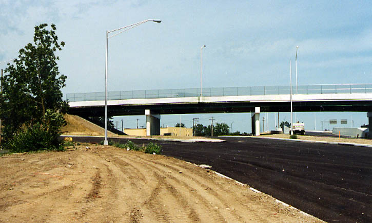
Looking towards where I-670 will be going. Thurber Tower is in the distance off to the left, Railroad tracks and previous I-670 construction to be bridged over are closer to us.
I-670 at Spring-Sandusky Interchange, August 2003
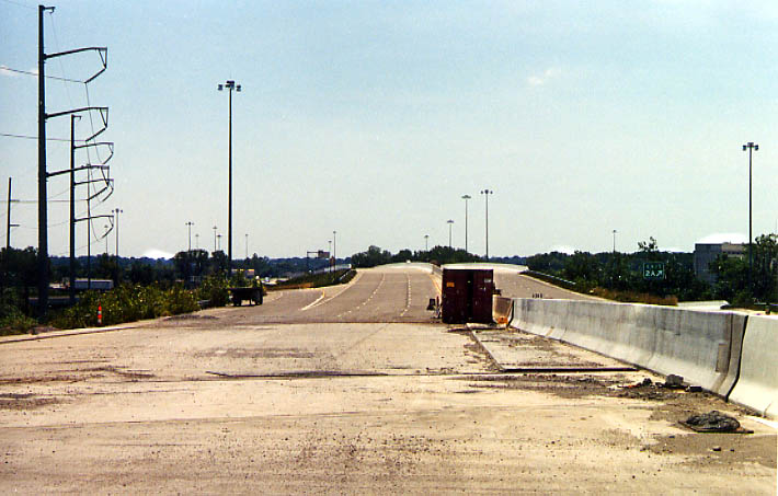
The EB Lanes don't end here anymore. Same location (as best as I could remember) as the top picture above.
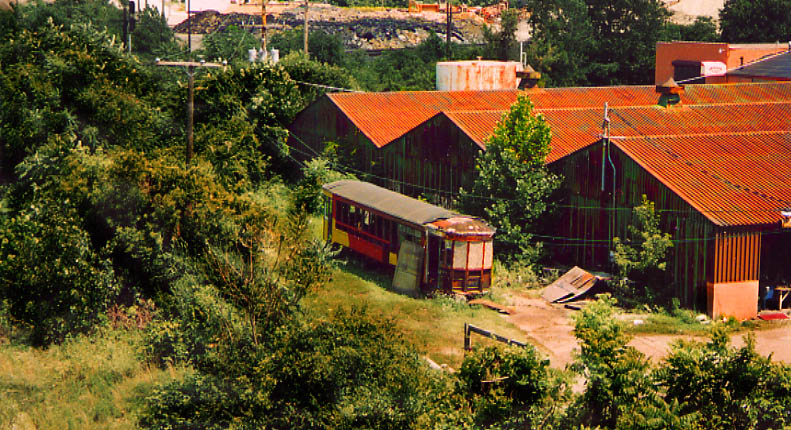
Anyone missing a trolley car after all these years? These sheds here are on the southside of I-670 between Oh 315 and Neil Ave and were the former home of a railyard in the days prior to Urban Renewal (see the Bergendoff Plan page). With the further completion of I-670, more of this area can be seen now (and is sure to be next on the list of areas to be cleaned up in Columbus in the near future).
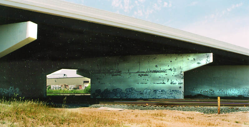
I'm not sure what attracted me to this "work of art." The rest of the "corperate paint" seems to be falling apart as well.
From above the railroad bridge, in the picture above, looking east towards Thurber Towers. You can see I-670 bend to the right with a slip ramp to I-670 WB on the left. Nationwide Arena would be to your right outside of the picture.
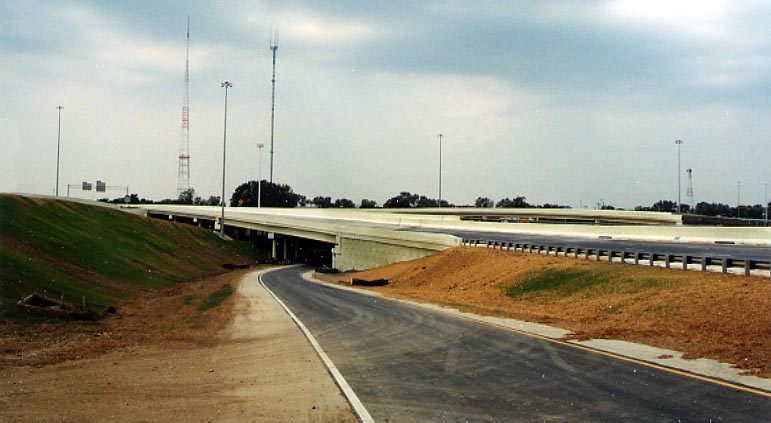
This is the ramp from Oh 315 SB to I-670 EB. The roadway going over the top is I-670. At the end of the bridge I-670 turns slightly to the right. Everytime I drive over it I think the backend of my car wants to slide out to the median barrior. Nice designing there ODOT! (Photo from Sept.15, 2003)
Other Points of Interest with Spring-Sandusky
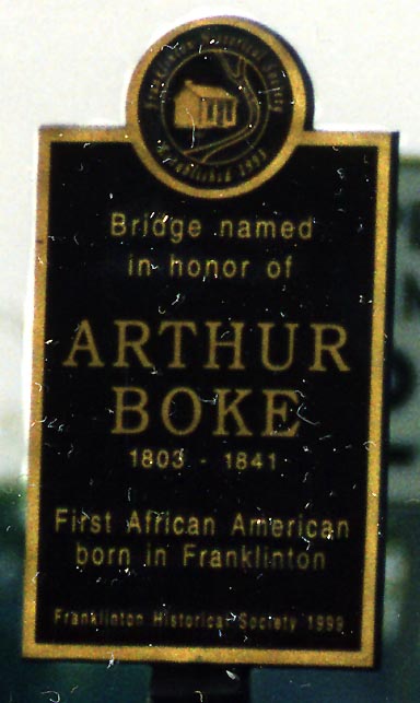
Among the other parts of the rebuilt Spring-Sandusky Interchange was the extension of Sauder Ave over the Scioto River to Spring St (US 33). This gave motorists an alternate way in and out of Franklinton, important due to the barring of traffic going from Oh 315 SB to the exit for W. Broad St (US 40).
While the new Sauder Ave Scioto River bridge is unassuming (standard concrete supports and steel frame design), the bridge did get a name (see left) thanks to the Franklintown Historical Society.
Photo from September 19, 2003
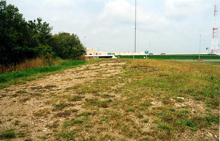
This unassumiming hill of grass and gravel was once part of
the roadbed for a portion of the original Spring-Sandusky interchange.
Amazing how things change.
Photo from September
19, 2003
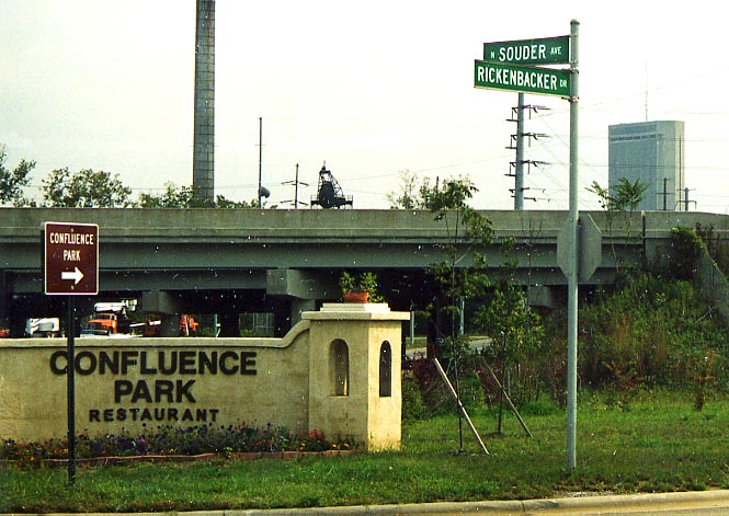
For twenty-five years, after the west innerbelt was completed,
there was direct access from the expressway (back when it was
still refered to as I-71) to a maintance shed at the confluence
of the Scioto and Olentangy Rivers (see Downtown
Columbus page). That access road was closed several years
before the reconstruction started. Once Oh 315 was reopened in
2001, the access to the Maintance building was reestablished it
was reopened as a restaurant and park with the access road named
after Eddie Rickenbacker (see the photo).
Photo
from September, 2003
I-670 at the High St. Cap - August, 2003
I might be extending the boundary of the High St cap a little
bit to the west, but when you drive under it you won't know the
difference.
In this picture I am looking east towards
the crossing of Goodale and Front Sts over I-670. Goodale Park
is on the left, and that yellow point in the middle of the picture
is actually part of the businesses making up the actual cap itself
along High St. Neil Ave would be behind me in this picture.
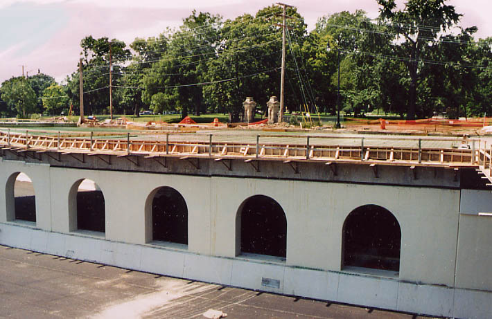
A cross section of the concrete arches that will carry Goodale St over I-670 (WB lanes in this instance) between Front St and Goodale Park. At the time of the photo, the concrete had yet to be poured for the roadway.
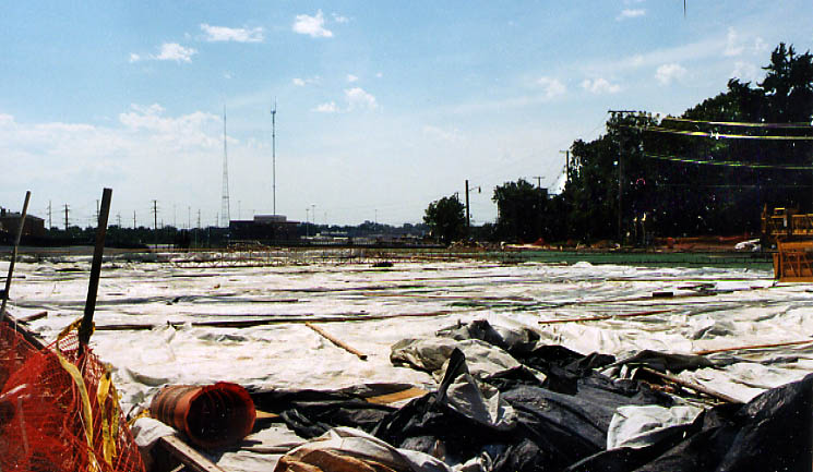
Looking west now across what will be Goodale St. over I-670. That is Goodale Park on the right. The tarps cover concrete that has been poured for curing purposes (so it sets properly and won't have to be replaced in a year or two), while rebar and girders are being set for more concrete to be poured on the right.
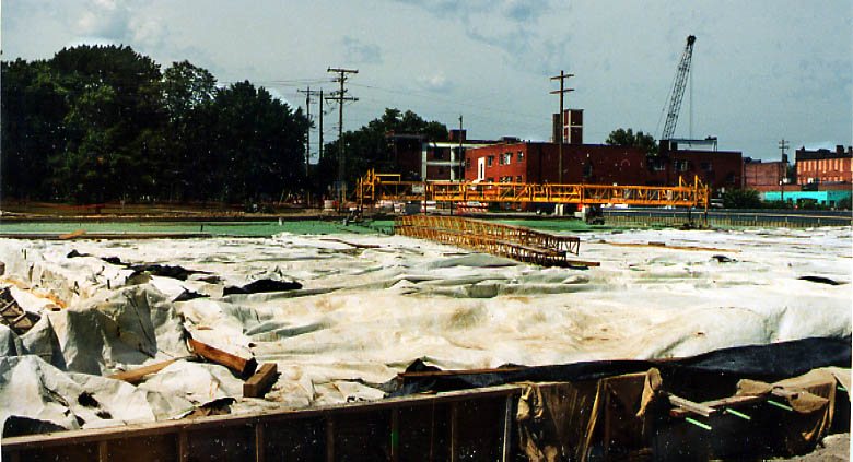
A more northerly view of the Front/Park-Goodale St intersection/bridge over I-670. That is Spruce St heading straight.
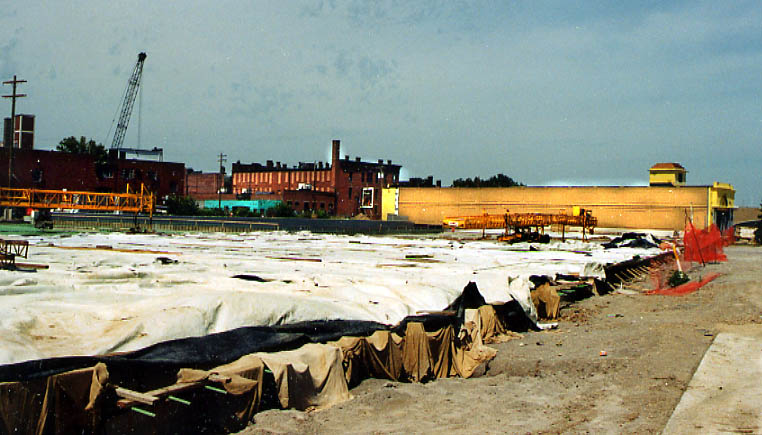
Front/Park and Goodale St. bridge over I-670 again. This time I'm looking east, the orange building is the west side of the actual High St cap over I-670. (as evident by the long bridge here, you can see why I extended the "cap" back to Goodale Park)
Intersection of Goodale and Front/Park over I-670, now a little more complete (from September 14 - Via Colori Party).
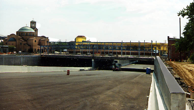
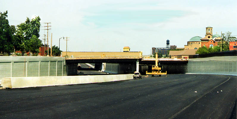
Now I'm east of High St and looking west towards it. At this time only some of the framing had been put up for the east side of the High St. cap, while only the exterior of the west side of the cap looks to be completed at this time.

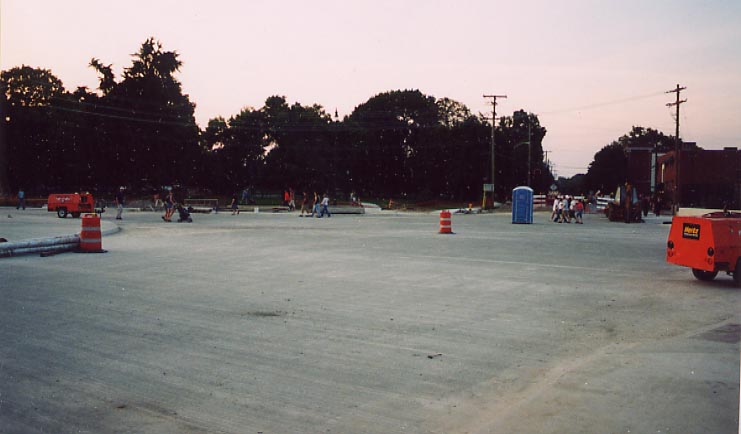
This photo was from the morning of the grand opening for I-670.
A solitary television reporter with no person (or car) near her.
Yes that microwave attenna is tall, but it might be barely taller than the cap buildings.
Photo along I-670 between High and 3rd Sts from September 19, 2003
Boy, I hope they decide to add some guardrails here before they open the highway back up. The road curving from the left is the ramp from 3rd St (US 23 SB) to I-670 W meeting up with the ramp from 4th St (US 23 NB). I-670 itself is on the far right of this picture. The bridge going over I-670 is for 3rd St.
Links
MSI Engineering High St Cap animation (need I tell you it's a large file?)
City Comfort Blog -page(s) covering the I-670 cap
Short North Gazette - July story about the High St cap
Page created on September 13, 2003/ last updated on November 11, 2003
Questions, comments, and submissions can be sent to Sandor Gulyas
Return to I-670 Photos | Columbus Virtual Roadtrip | Spring-Sandusky History Page