This is a tight freeway loop around downtown Youngstown, similar to the Inner Loop in Rochester, New York, comprised of parts of I-680, US 62/Ohio 7, US 422, and Ohio 193 (Aerial photo). The atlas of Mahoning and Trumbull Counties by Commercial Survey Company calls the I-680 section "Wickliffe Drive" (on the main maps) and "South Shore Drive" (on the downtown inset); the US 62/Ohio 7 section the "East River Crossing"; and the US 422/Ohio 193 section the "Madison Avenue Freeway" with its bridge over the Mahoning River called the "West River Crossing" (John Taber confirms the last two names as being official), or, informally, the "Blue Bridge".
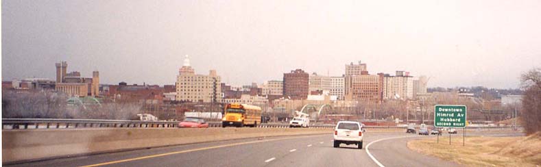
The Youngstown skyline
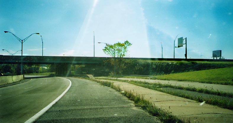
From I-680 Southbound approaching Market Street within the downtown loop
The West River Crossing
Approaching the crossing. This is the west end of the Madison Avenue Freeway and is also the south end of Ohio 193.
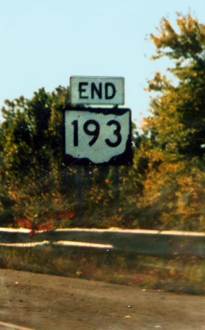
The official designation of the south end of Oh 193, before crossing the Mahoning River and the intersection with I-680. Photo from October, 2003
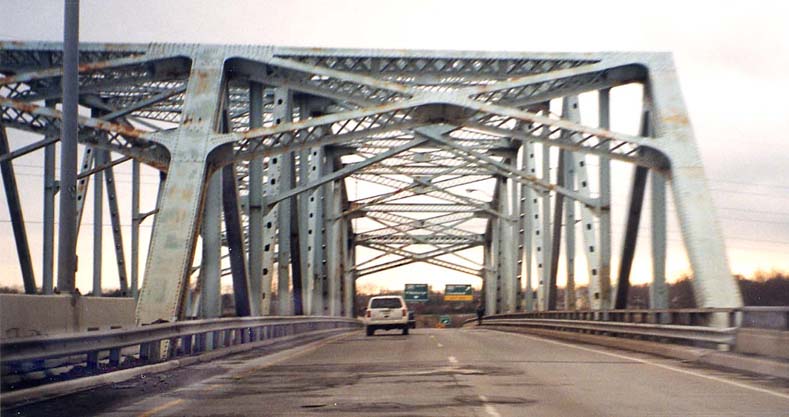
At the crossing going westbound...
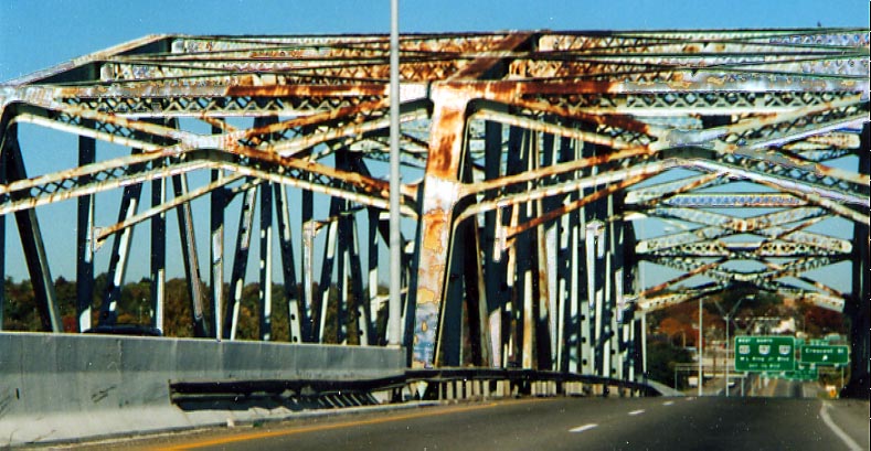
At the crossing going eastbound... (Photo from October, 2003)
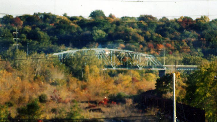
In the distance from OH 711/Division St (Photo from October, 2003)
Madison Ave. Freeway
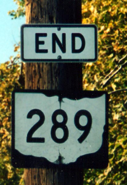
ODOT has extended Oh 289 from its original end point at US 422 on the east end of the Youngstown loop, through Downtown Youngstown so that Oh 289 ends at the interchange for US 422 and Oh 193 (Junction of Martin Luther King Blvd, Wert Ave, Federal Ave, East River Crossing, and Madison Ave. Freeway)
Does not help matters that the Oh 289 shield and the 'End' sign do not seem to be getting along in this photo either.
Photo taken in October, 2003
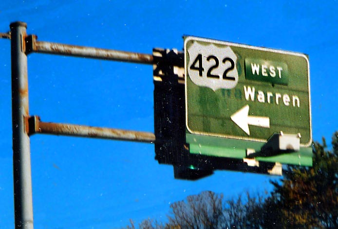
Can I get a US 422 shield supersized? You can see the marks
on this sign from where everything lined up previously. Wick Ave
at Madison Ave. Freeway
(Photo from October, 2003)

The Madison Avenue Freeway - Westbound
East River Crossing
As US 62/Ohio 7 (East River Crossing approach) approaches the Madison Avenue Freeway (US 422) overpass going southbound on the east side of the loop, a mysterious on-ramp appears to the right of the highway from nowhere after the ramp to the Madison Avenue Freeway Westbound branches off, then merges into it. This ramp is visible (it's bright white) in this aerial photograph.
Speaking of East River Crossing, this is the northern terminus
for it here at Albert St. It was to continue east as the Hubbard
Parkway (US 62/Oh 7) to Liberty/Early Rds, then turn to the north
and end at I-80 between Oh 193 and present day US 62/Oh 7. As
you can see, that's not going to happen anytime soon.
(Photo
from October, 2003)
The East River Crossing meets South Shore Dr.
US
62 and Ohio 7 follow the freeway with the East River Crossing
from its northern beginning to its western terminal interchange
at I-680 where 62 and 7 then follow city streets (South Avenue,
Williamson Avenue, and Market Street) while avoiding joining I-680
itself. (Hopefully this new photo is better than the old one)
South Shore/Wickliffe Dr
One of Marc's favorite. A Diagraphical Sign. This one is along I-680 NB approaching the West River crossing (From October, 2003)
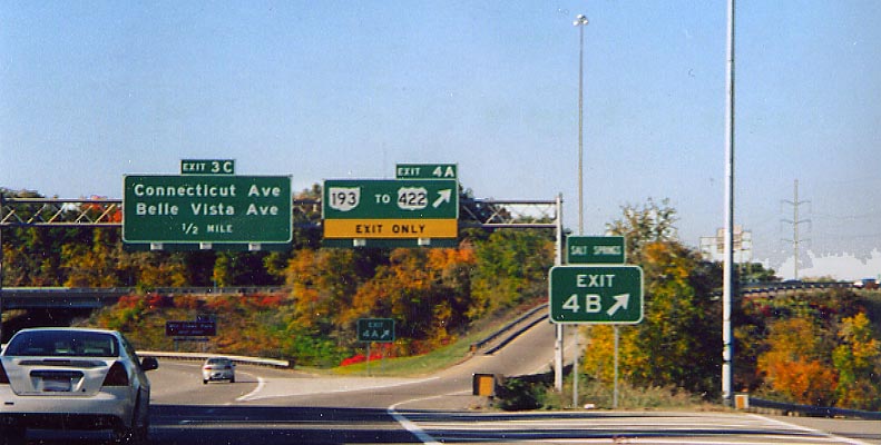
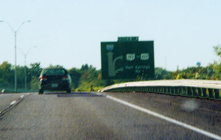
We'll just slip this ramp here in front... While mentioned on the Diagramical sign above, Salt Springs Rd. barely gets a fleeting mention in front of the West River Crossing Trumpet interchange. (Photo from October, 2003)
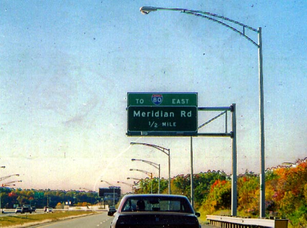
North of the Youngstown Loop, I-680 is refered to, on the local maps, as Wickliffe Dr (Wierd name for a freeway). Also due to popular demand, ODOT instead of building a ramp from I-680 NB to I-80 EB, directs traffic, trying to go in this direction, to use a couple of local roads (and does a decent job of signing it as such). There has always been an exit for Meridian Rd since I-680 was completed, but the I-80 addition, replacing the exit number, was added in the late 1990s. (Photo from October, 2003)
Elsewhere in Youngstown

The junction of Federal, Belmont and Mahoning (almost) Sts on the west end of the Youngstown Business District. (Photo from October, 2003)

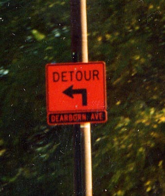
Above Photo: For some reason Youngstown (or ODOT) decided to try orange on black for the streetname instead of the standard black on orange as seen with the Detour sign. (Along US 422 between Oh 711 and I-80)
Left Photo: Youngstown reversing streetsign colors some more. This time it's green text on a white background instead of the standard white text on green background (talk about going in reverse)
Both photos taken in October, 2003
![]()
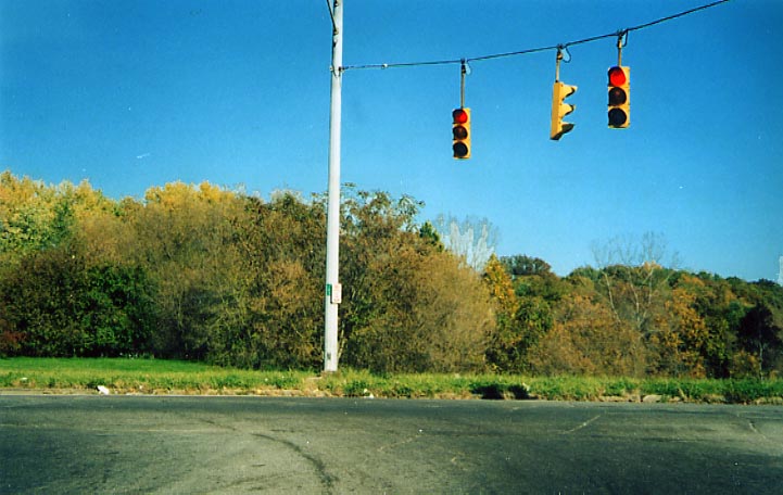
A relic from a bygone era. Not sure why this one 4-way beacon traffic light is still standing along Federal St, err, Martin Luther King Blvd (US 422) between Oh 711 and I-80. (Photo from October, 2003)
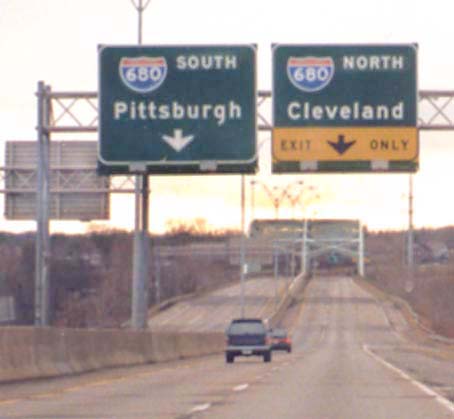
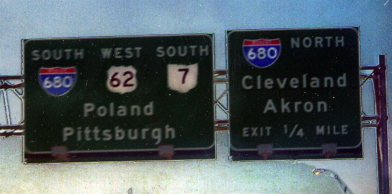
Note: The rivalry between the Cleveland Browns and the Pittsburgh Steelers National Football League teams (and to some extent their respective cities) is well-known, so it's interesting to note that both cities are listed on the same sign gantry in three of the photos above, and on the same sign in another!
Page created on December 30, 2002/Last updated on April 9, 2005
Question and comments can be sent to Sandor Gulyas or Marc Fannin
Return to Youngstown Virtual Roadtrip