|
|
If you visited (The!) Ohio State University back in 1960 and didn't visit again till 2002, you'd notice the vanishing of some significant streets (and the addition of a bunch of buildings!). Most notable of the subtractions would be North Oval Mall (Location obvious to those who know OSU), and Neil Ave from 18th Ave. to Lane Ave. Also missing is a trafficlight or two along 17th Ave. |
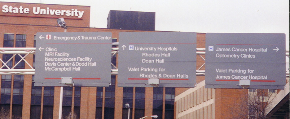
The Ohio State style on road signage. Taken within the Ohio State University Medical Center complex on the SW corner of the OSU campus.
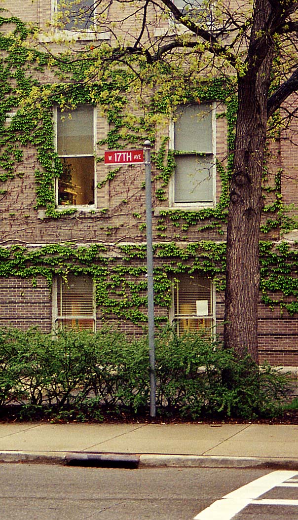
A solitary streetmarker in the Ohio State Campus. This particular street was semi-corden off in the mid 1990s (gates block the way, but busses and cars with special passes still can come through) There used to be a cross street here (thus the reason for the streetsign), but that particular steet was done away with back in the 60's. BTW, the building behind the sign is Brown Hall.
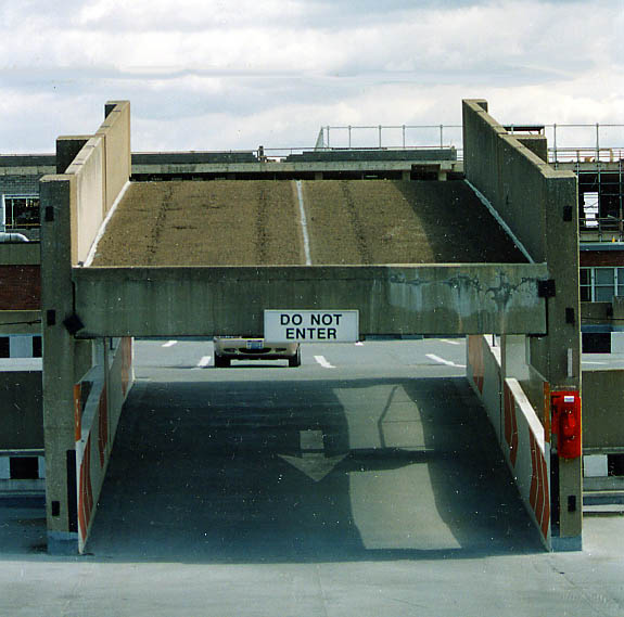
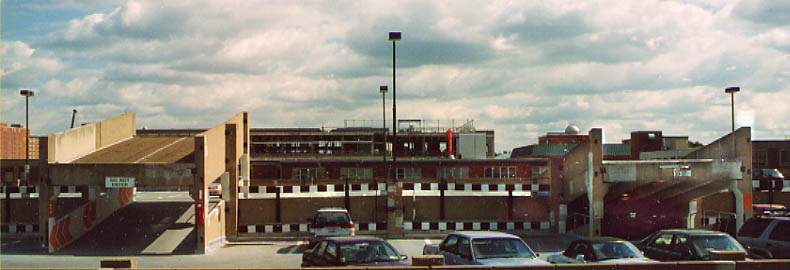
Is this someone's idea of a joke or future planning? These
ramps at the top of this parking garage go to nowhere (especially
this one on the left and top).
Both the top and
bottom photos were taken in September, 2003.
Roads turned bike-walkways around Ohio State
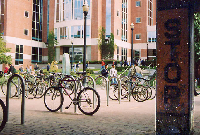
What is today a parking lot for bikes was once a T-intersection between a maintance lot and a side street. So to stop traffic, OSU did the only sensible thing back then. Paint 'Stop' on a right side post. As it was black text on a yellow background, one can tell it was established many, many, many years ago.
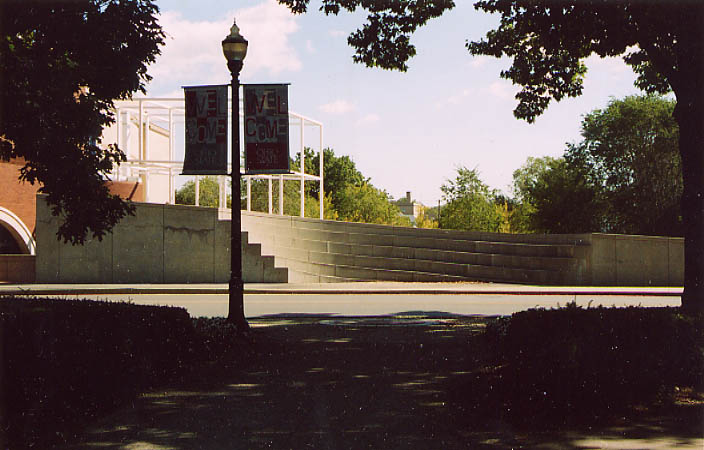
Back when the automobile was the end all, the Ohio State Oval (and library) was ringed by a road. This road was call Oval Mall (with north and south designations for whichever side of the oval you were on). Sometime back in the 1960s, Ohio State did a bit of urban renewal and took out the ring road replacing it with this wide sidewalk (and trees). However, several of the buildings still use Oval Mall for their address (Derby Hall for example)....
This is where North Oval Mall would of met with College Rd, which in turn would meet with (just to the right out of the picture)...
With another road (an extension of 15th St esentially) leading
out to High St ahead. This road was blocked/taken out back in
1991 (give or take a year) with the construction of the Wexner
Art Center (see to your right). This has lead to there being no
direct access to the Ohio State Campus from High St now.
All
reclaimed street photos are from October, 2003
Renamed Streets
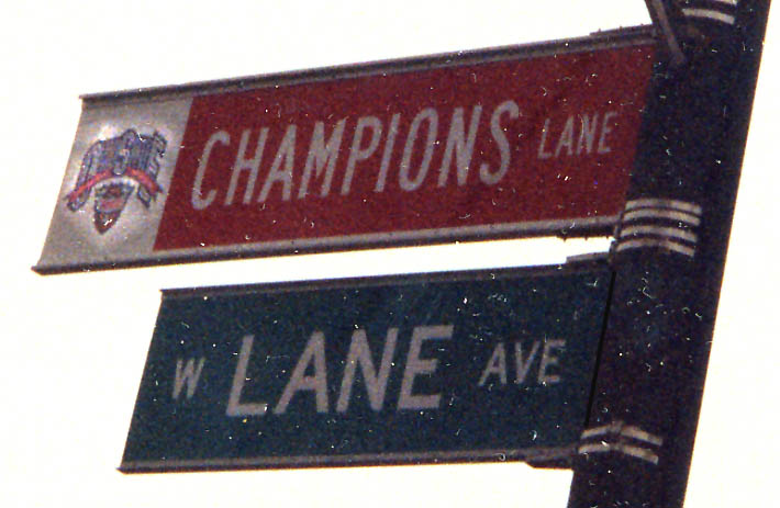
Lane Ave was remaned to Champions Lane (through the Ohio State campus) after the football team won the 2002 National Collegic Championship in football.
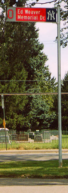
Who is Ed Weaver and what does he have to do with the New York Yankees and Ohio State?
I got my answer in July of 2003 from Ron Whisler:
"Ed Weaver was the former athletic director of Ohio State in the 70's and 80's. He was also part owner of the New York Yankees AAA team the Columbus Clippers before he died a few years ago. He may have also had stake in the Yankees too." - Thanks Ron.
You can see several of these roadsigns along Olentangy River Rd between Ackerman Rd and North Broadway (photo from June, 2003)
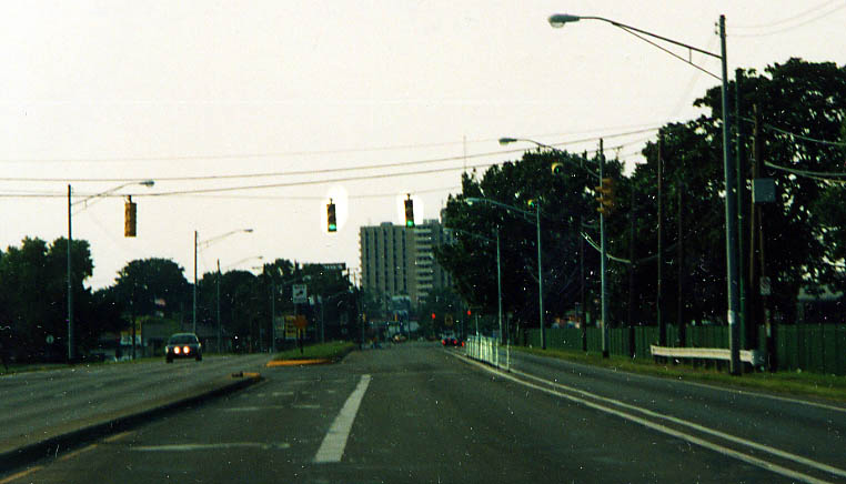
A interesting traffic routing measure. The right lane of NB
Olentangy River Rd is seperated from the rest of this T-intersection,
thus one lane can always move on, while the rest of the traffic
has to obey the cycle of the traffic light here. It should also
be noted that the seperated lane does have one bulb green arrows
to encourage drivers not to stop when the rest have red lights.
This is the only instance of this kind of setup for traffic that
I'm aware of in Columbus.
Along Olentangy River
Rd between Ackerman Rd and North Broadway (photo from June, 2003)
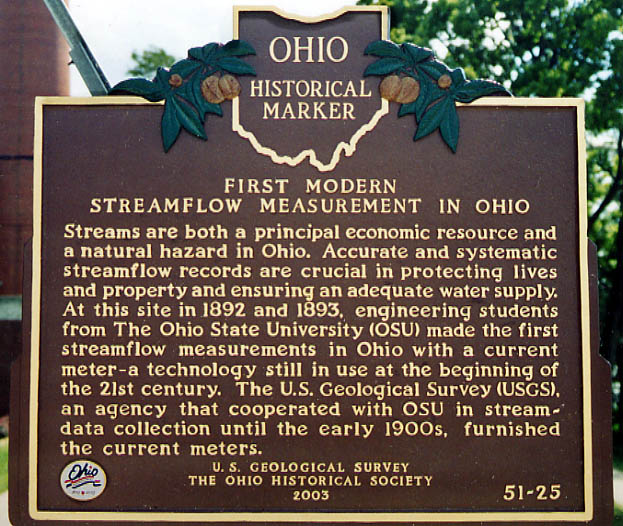
This plaque is found at the east end of the King Ave bridge
over the Olentangy River. Couldn't they think of something better
that happened at Ohio State?
(from August, 2003)
Ohio State Gateway Project
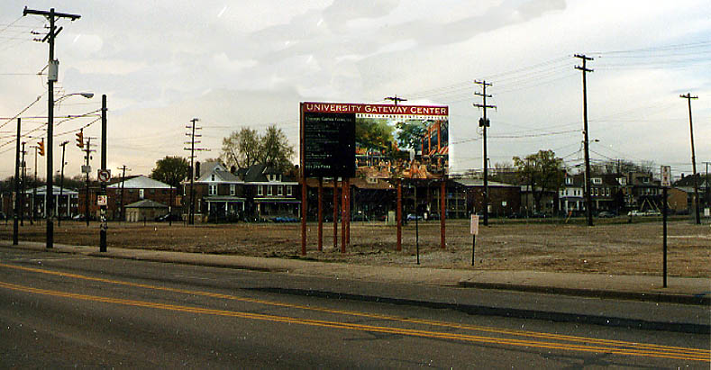
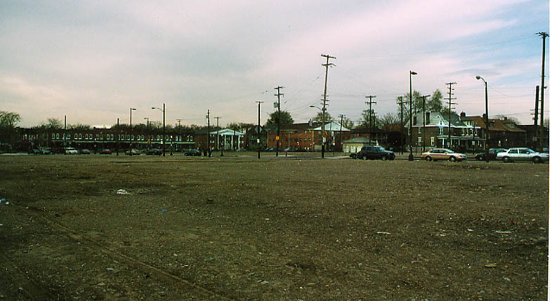
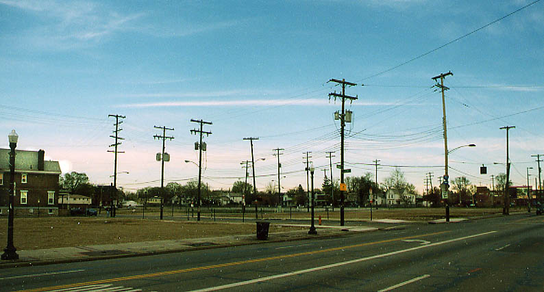
Who says old fashion urban renewal is dead? Ohio State University and a qusi-public/private group called "Campus Partners" bought up properties along N. High St, just south of the (actual) Ohio State Campus that were deemed to be, for a lack of a better word, "Slums." Out went a bunch of bars, businesses, and housing. and for the last 4 years (at least) these empty lots are all that are left. Mind you there has been an undercurrent of protest by some students, professeurs, and residents to this project since it started.
I went about photographing this area because I find it erry to see all these electric and telephone poles standing (along with the street signs) with no buildings. It just looks odd. I hope these photos show this feeling. (Photos from June, 2003)
As of September 5, 2003 work has finally started on the Gateway project. Sewer and water lines are now being relaid along High St.
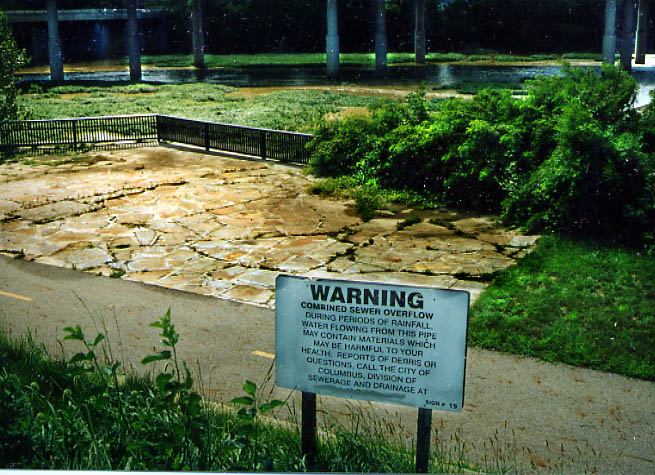
I just found this to be an odd juxstoposition. Someone droped a sewer pipe (or worse, some sort of discharge from Battille?) near this viewing location of the Olentangy River and bike path. A sad state of affairs. Between 5th Ave and King Ave. (Photo from August, 2003)
Links
New OSU Hospital exit: Official plans | Discussion
Page created on September 17, 2003/ last updated on August 25, 2004
Questions, comments, and submissions can be sent to Sandor Gulyas
Return to the Columbus Virtual Roadtrip