Memphis
Highways
Memphis Bridges
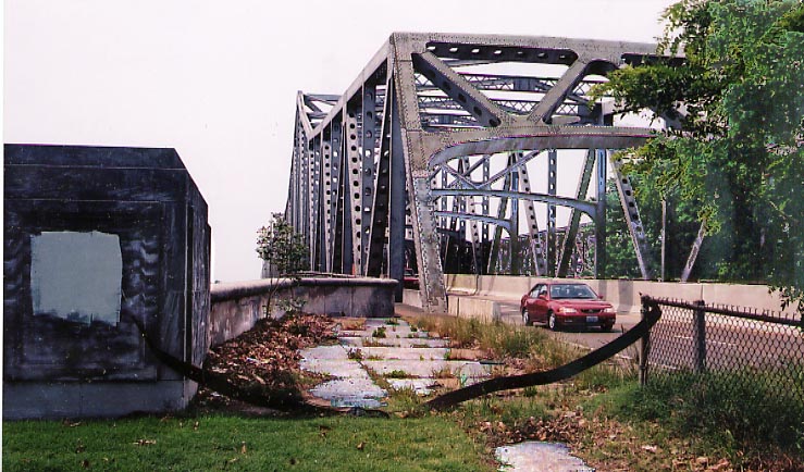 Not much separating traffic from straying pedestrians
here on the southside of the I-55 Mississippi bridge in Memphis.
I guess one could try to walk along the southside of the bridge
if the girders don't get in your way.
Not much separating traffic from straying pedestrians
here on the southside of the I-55 Mississippi bridge in Memphis.
I guess one could try to walk along the southside of the bridge
if the girders don't get in your way.
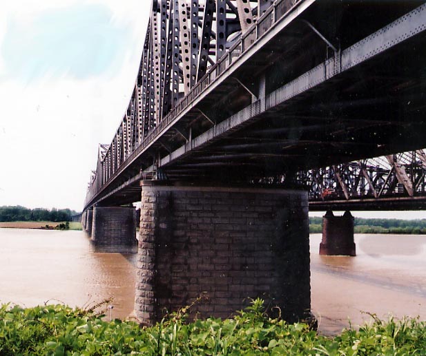 One of the supports for the I-55 bridge. Built in 1949,
it was originally named E. H. Crump Bridge (to go along with Crump
Blvd. east of I-55), but more commonly referred to as the Memphis-Arkansas
bridge. It did get mentioned in the Chuck Berry song, "Memphis,
Tennessee."
One of the supports for the I-55 bridge. Built in 1949,
it was originally named E. H. Crump Bridge (to go along with Crump
Blvd. east of I-55), but more commonly referred to as the Memphis-Arkansas
bridge. It did get mentioned in the Chuck Berry song, "Memphis,
Tennessee."
(last fact stolen from the book
Blues Traveling)
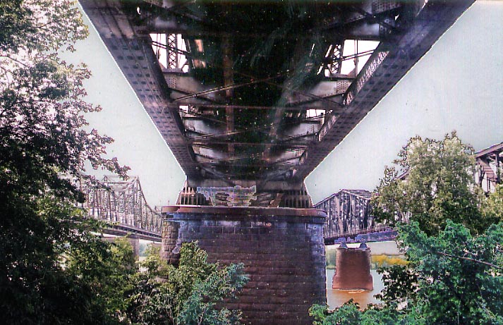 Along with the highway traffic on the left, there are
the 1892 Frisco Bridge and the 1917 Harahan bridges for railroads
to cross the Mississippi River next to I-55 (All 3 photos above
were taken in May, 2003)
Along with the highway traffic on the left, there are
the 1892 Frisco Bridge and the 1917 Harahan bridges for railroads
to cross the Mississippi River next to I-55 (All 3 photos above
were taken in May, 2003)
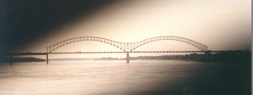 The Hernando de Soto Bridge. Built in 1972 it carries
I-40 across the Mississippi River. Does it remind you of any part
of the alphabet?
The Hernando de Soto Bridge. Built in 1972 it carries
I-40 across the Mississippi River. Does it remind you of any part
of the alphabet?
(Photo taken in June, 1999)
Sam Cooper Blvd.
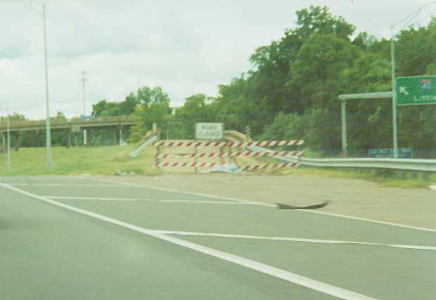
 I-40 was originally intended to run through Memphis's
eastside, roughly following Summer Ave/North Parkway, but it would
have gone straight through the Memphis Zoo and a middle class
black neighborhood (Overton Park). The would be freeway eventully
was extend to (and ended at) the eastside of Overton Park short
of it's intended target. Since 2000, the City of Memphis has made
a consious effort to clear the physical scars of Sam Cooper's
intended path from the landscape.
I-40 was originally intended to run through Memphis's
eastside, roughly following Summer Ave/North Parkway, but it would
have gone straight through the Memphis Zoo and a middle class
black neighborhood (Overton Park). The would be freeway eventully
was extend to (and ended at) the eastside of Overton Park short
of it's intended target. Since 2000, the City of Memphis has made
a consious effort to clear the physical scars of Sam Cooper's
intended path from the landscape.
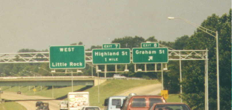
In this photo,
from June, 1999, a (then) recently refinished overhead sign gantry
intones to the travelers that I-40 was going to be here (the next
city west of Memphis for I-40 is Little Rock, just like that sign
on the left) (BTW, as of June, 2005 the above sign was still in
use)
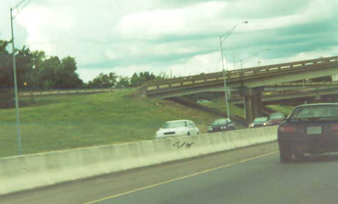
 Would be ramps for I-40 to continue east from I-240
near Downtown Memphis (Photos taken in Sept. 2001) (Now
no more)
Would be ramps for I-40 to continue east from I-240
near Downtown Memphis (Photos taken in Sept. 2001) (Now
no more)
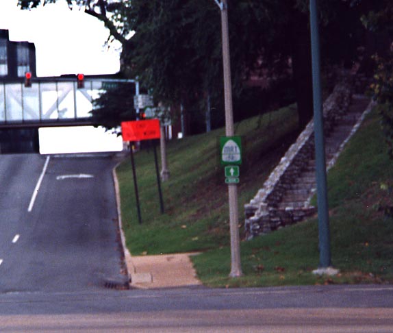 A trail blazer for the Mississippi Riding Trail along
the Memphis Riverfront. The bicycle equivalent to the Great River
Road, following the Mississippi River from Louisiana to Minnesota.
(Photo taken in Sept. 2001)
A trail blazer for the Mississippi Riding Trail along
the Memphis Riverfront. The bicycle equivalent to the Great River
Road, following the Mississippi River from Louisiana to Minnesota.
(Photo taken in Sept. 2001)
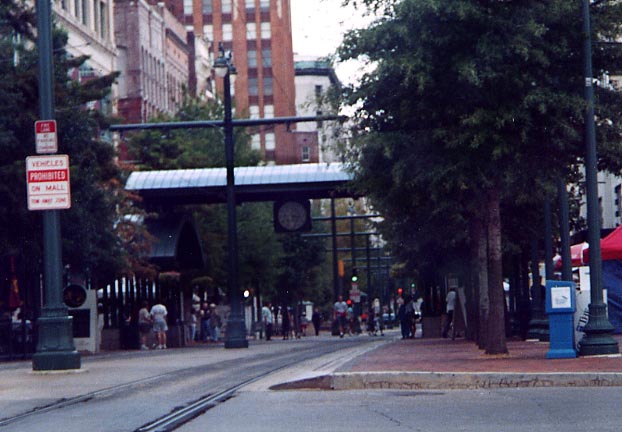 Main St, north of Beale St, becomes a pedestrian mall
and streetcar path. Nothing blues related along this way however.
(Photo from Sept. 2001)
Main St, north of Beale St, becomes a pedestrian mall
and streetcar path. Nothing blues related along this way however.
(Photo from Sept. 2001)
Companion pages
Beale St in the Daylight
Other Memphis Blues photos
Memphis
Freeways - By Michael Adams. The past, current, and Future
alignments of Highways in Memphis.
City of Memphis and Shelby
County Division of planning and development
Page created on January 14, 2004/ Last updated on July 4,
2006
Questions, comments, and submissions can be sent to Sandor
Gulyas
Return to the Key to the Highway
page