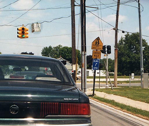
Occasionally, municipalities will put signs up to alert motorists that nearby residents might be lacking lacking abilities that the rest of us take for granted. In this instance, the placement and color could be better done if motorist are supposed to see that Blind people are using this intersection. Oh 12, eastside of Fostoria by the fairgrounds
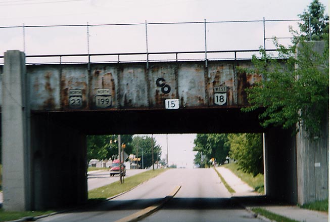
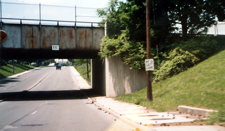
While US 23/Oh 199 and Oh 18 share the same street, they are kept seperate through this set of Railroad bridges. US 23/Oh 199/Oh 18, SE Fostoria
City sign lacking a state route shield to direct traffic along Oh 12, south of Downtown Fostoria
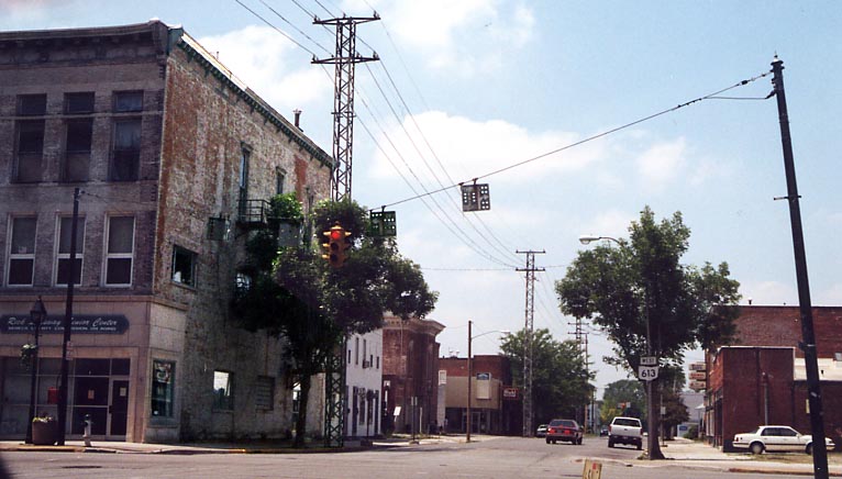
On the north end of the business district, one can see aluminum electric wire poles/supports and these overhead lane designation signs (with explanations) and holes for the wind to go through. Oh 613 near downtown Fostoria
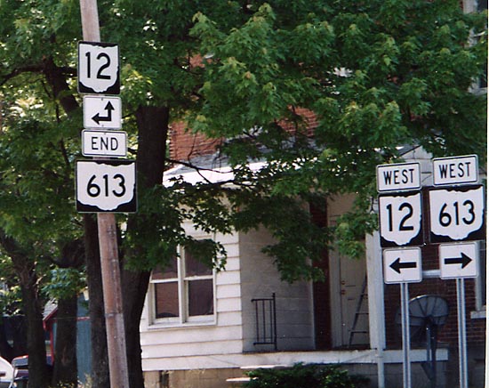
Oh 613 piggy-backs along Oh 18 from the west into Fostoria (falling into the category of non-standard Ohio routes). Many years ago, Oh 613 was an western extension of Oh 113.
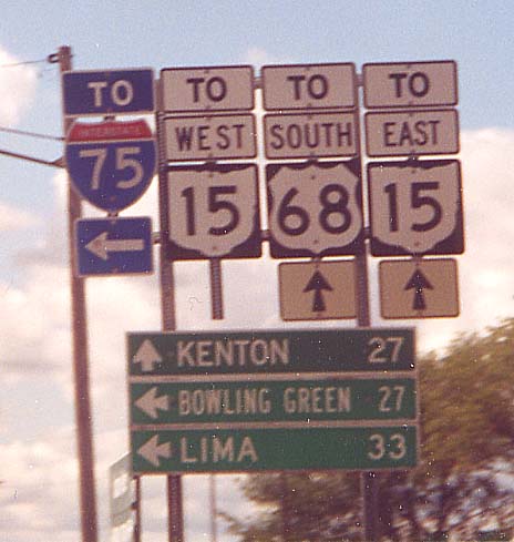
This is where Lima Avenue meets US 68/Ohio 15 just south of I-75. Lima Avenue is old US 25 (though the old route becomes the 68/15 ramps at the interchange, with the crossunder being on a newer arcing roadway -- map).
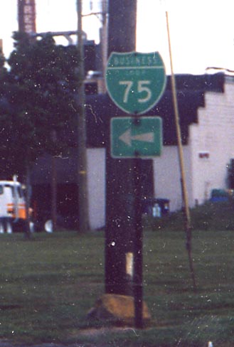
Lima Avenue now carries Business Loop 75 into downtown Findlay, which then continues on Main Street. This Business Loop 75 shield is near BL-75's southern end at US 68/Ohio 15
US 68 runs, and is signposted as, north-south in Ohio. The other end of US 68 is in Western Kentucky, just southeast of Paducah.
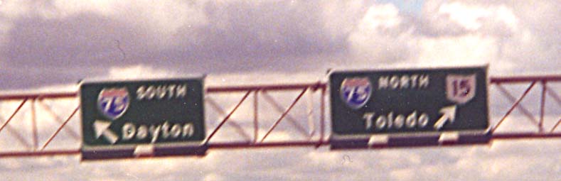
I-75 - a major Interstate highway running from northwest of Miami, Florida, to Sault Sainte Marie, Michigan and the Canadian border.
Diagrams like this used to be common place along Ohio interstates (I remember signs similar to this along I-70 on either side of the Oh 79 interchange in Licking Co through the late 1980s). However this is the first one I've seen for a cloverleaf in over a decade.
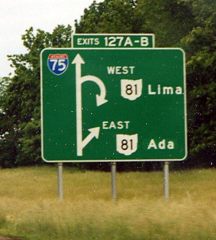
And if you look very closely at where it says Ada, you can notice the color is slightly lighter, as if the eastern designation for Oh 81 has been changed.Along I-75, east of Lima
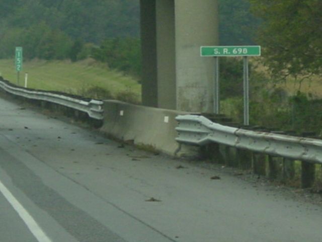
This submission comes from Dan Garnell (of State-Ends.com fame). Marc and I have discussed, on our other Ohio pages, the comings and goings of Ohio's signage for bridges along interstate routes. In this case Dan saw that ODOT, along I-75 in ODOT District 1, is signifying overpass road names. But instead of putting the name on the bridge above, the names are beneith the bridge on the right shoulder of the freeway. So far no one has yet to get a read as to this being a state wide phenomena or only regional. (I-75 SB @ Oh 698, from August, 2003. Thanks, Dan!)
This is a component of the PrePass system, which allows semi trucks to bypass weigh stations by electronically recording their information. South of Bowling Green on I-75 Northbound
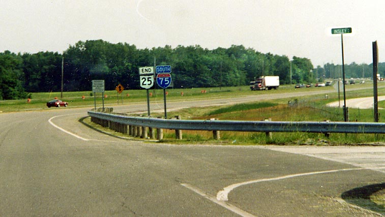
Nice place to end a highway. Oh 25 (which up to 1975 was US 25) southern terminus is at the begining of this ramp to I-75 south. The former US 25 would be beyond those trees ahead. (also see this page for Oh 25 terminus pictures)
This is southeast of Bowling Green, where US 6 is bypassing Bowling Green to the south. US 6 used to follow a route through town which now includes parts of Ohio 64 and Ohio 105.
Dual-unit distance sign on I-75 Northbound.These are found
in various places throughout Ohio and various other states.
Since this picture was taken, the sign has been
removed
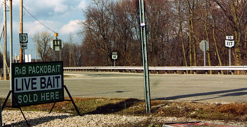
What's with the 'To Oh 117' assembly on the far right? Even though Oh 117 ends just beyond those trees at Oh 118 (and Oh 117's eastern terminus is US 33 near Indian Lake), the reminder for it seems a little unnecessary, in my opinion
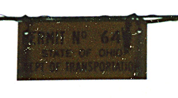
I guess I should of used a flash. This sign is for Permit No 64, by the State of Ohio Dept. of Transportation (for a traffic light that I cropped out). This was found in downtown Rockford
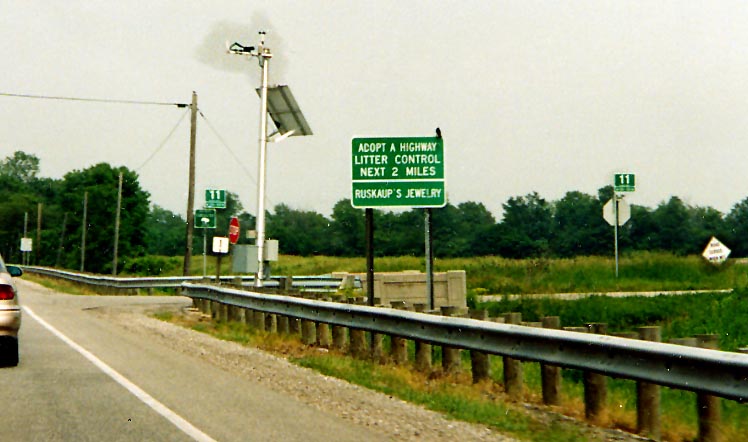
Ignore the Litter Control Sign for a moment. What I took this
picture for, was the mini weather station (just to the left of
the Litter Control Sign). ODOT has placed hundreds of these mini
weather stations around the state so they can keep track of the
weather to better serve drivers. (see
here)
Something else I noticed, after I took
this photo, is the sign on the very far right. It says 'Road Closed
When Wet.' Now a road being closed because of flooding or part
of it being washed out I can understand, but just because it is
wet?!
Along US 24 in Paulding Co.
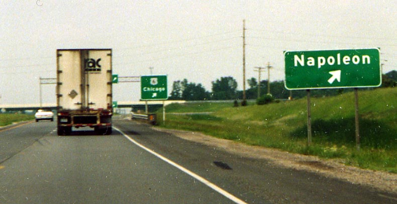
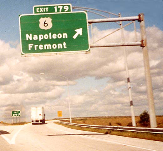
Near the interchange for US 6 and 24, outside of Napoleon.
I guess outside of Indianapolis, there is nothing in Indiana for
Ohio to use as an Control City.
Thus US 6 west
to....Chicago(Ill)
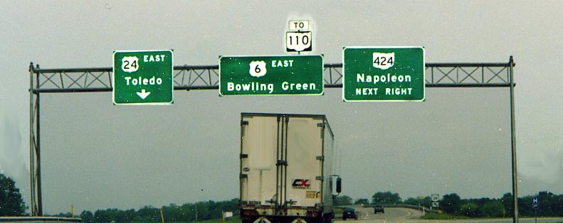
The northern end of the Napoleon by-pass. Oh 110 has garnered enough importance to get an add-on shield to an US 6 BGS, but not enough importance to be included on a green sign.
Page created on December 17, 2002/last updated on December 12, 2003
Questions, Comments, and Submissions can be sent to Sandor Gulyas
Return to NW Ohio Regional Page