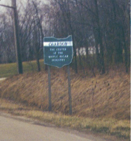
Ohio Historical Society city entrance sign
Ohio
Historical Society city entrance sign
Various cities and villages in Ohio have this type of sign
posted at their limits on main highways, in addition to the official
city limit sign and the the civic sign posted by the municipality.
This one says
"CHARDON" "THE CENTER/OF THE/MAPLE SUGAR/INDUSTRY".
On Ohio 44 Southbound
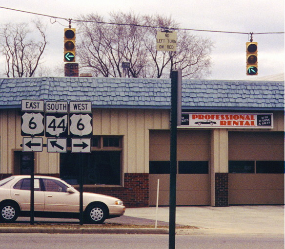
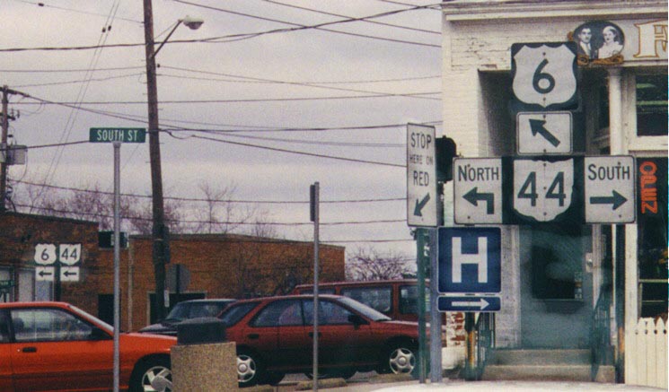
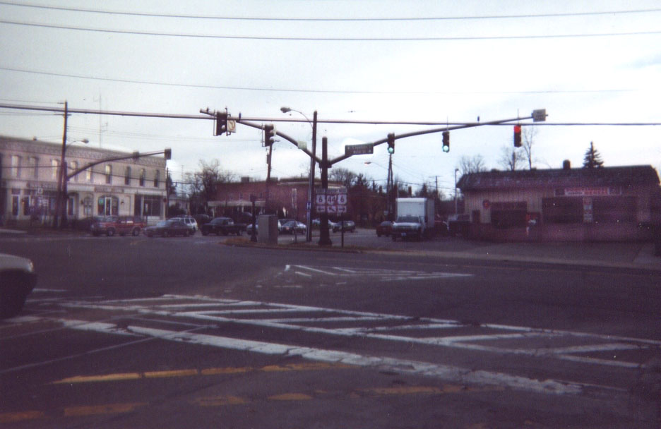
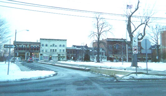
The following pictures were taken around Chardon Square in downtown Chardon in 1998. The square is formed by two parallel east-west streets and two north-south streets which connect them. There are also streets extending away from the square at the north-center and south-center points. All of the square is one-way counterclockwise, except the west half of the southern leg. Each street has its own name. U.S. 6 enters from the west on the southern east-west road and leaves on the northern east-west road. Ohio 44 enters from the south, and used to exit to the north, but was rerouted in the 1960's to leave going west on the northern east-west road. Go here for a map.
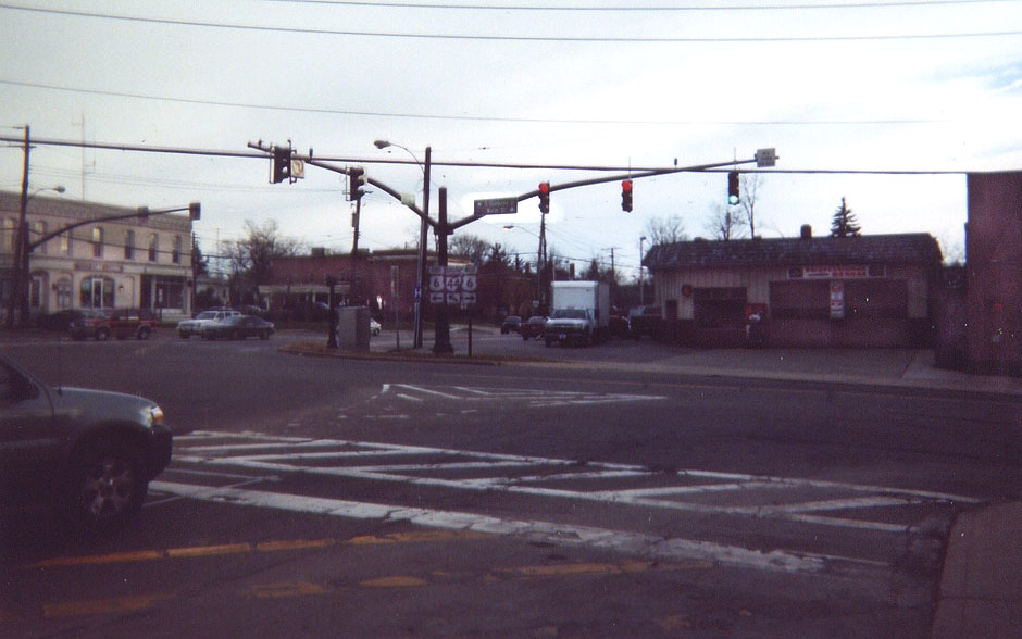
End
of west leg (southbound)
Two items of note:
The "geographically-correct" Ohio 44 marker (NOTE: Replaced by a more standard marker by March 9, 2005)
The route marker assembly and the traffic light both indicate that Ohio 44 Southbound goes at an angle to the left. However, there was an overhead lane-use sign (not pictured) for this traffic that used a straight "ONLY" arrow. We have seen slanted straight arrows elsewhere in Ohio, so I'm not sure why one wasn't used here. All three indicators for both the left- and right-turning traffic correspond with each other.
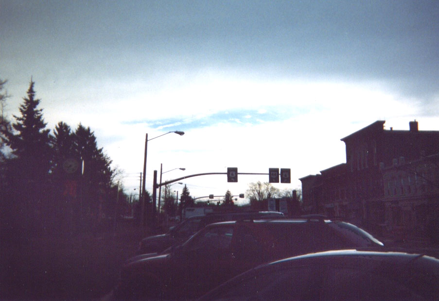
Signage
on south leg (eastbound)
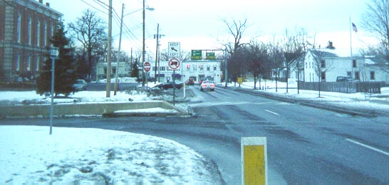
Another inconsistency. The near route marker assembly implies
that U.S. 6 and Ohio 44 Northbound take different routes from
there, when actually they run together (as the assembly in the
background correctly shows). Also of note are the large first
capital letters on the directions, and the Ohio 44 directional
sign set-up, the standard around Ohio.
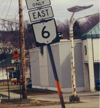
Note:
As of May 23, 2002, the arrow for 6 was the same kind as the arrow
for 44. By early 2005, most signage had been replaced.


After
Traffic
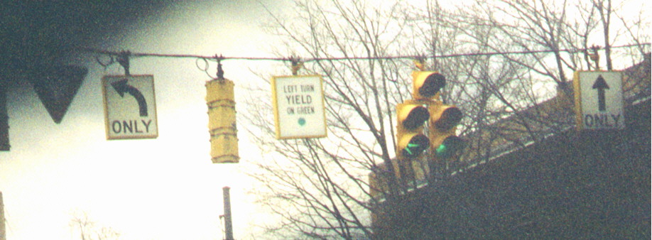
light assembly on north leg (westbound)
The five-lens "doghouse" light and the backlit signs
are relatively new; the other traffic signals and the "YIELD"
sign are not. (More backlit signs have been installed on the square
since this photo was taken in March, 1999.) Are the green arrow
on the light and the "YIELD" sign in conflict with each
other? Incidentally, the "LEFT TURN YIELD ON GREEN [ball]"
message, common in the Southern U.S., is being used increasingly
in Ohio.
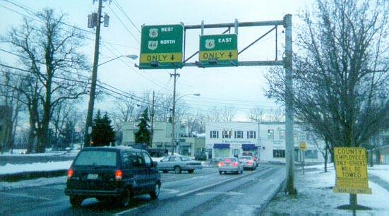
Overhead
signage on east leg
In order to avoid traffic paths crossing, these turnaround lanes (with parking spaces) in the middle of the square between the east and west legs are placed to the left of each other.
Here
is a photo of both seperate initities (above) together.
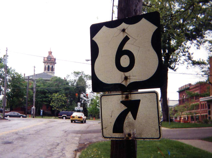
A
route marker goof, from early 1999 (this was located at a recently
rebuilt intersection). (Technicality: Ohio considers any state-maintained
route as a state route with that number regardless of class, thus
this sign was correct since this is Ohio State Route 6).
Note: As of April 10, 1999, this marker
had been replaced by a brand new U.S. 6 marker, barely two weeks
after the picture was taken!
Formerly on U.S. 6 in Chardon, at the Wilson Mills Road/Cherry
Street intersection, about ½ mile west of the Square
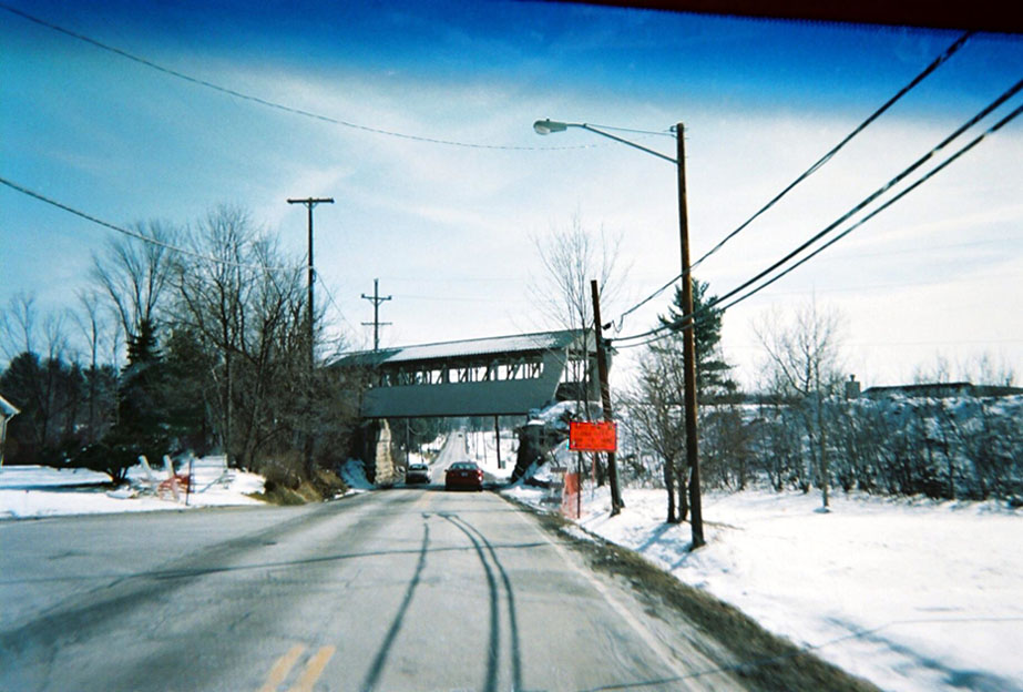
This bridge over Aquilla Rd (on the south edge of Chardon) didn't always look this nice. The ridge (and bridge) were once part of a Baltimore & Ohio track that ran from Warren to Fairport Harbor. Abandoned in the early 80s, it is now a bike trail that now runs through Lake and Geauga Counties. The covered bridge was a recent addition to spruce up the path. (Photo taken in 200_)
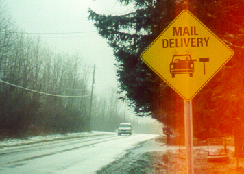
"Mail
Delivery" graphic sign northwest of Chardon
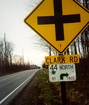
Temporary
Bypass Ohio 44 around Chardon
Every spring, Chardon hosts the Geauga County Maple Festival, which takes over the square. As a result, there is posted an unofficial temporary bypass for Ohio 44 through traffic following Mayfield Road (US 322) and Auburn and Clark Roads posted with these signs.
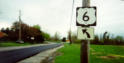
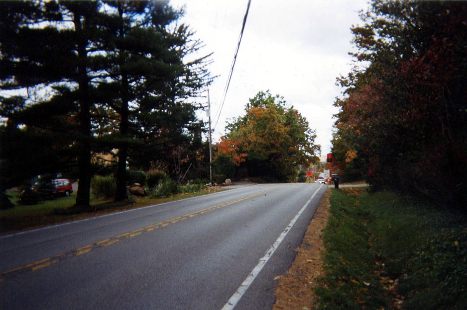
Ohio's arrow markers for route markers used to have widening arrow stems. As a result, certain combinations required some changes from the standard, such as the one above for a straight-then-45-degree-turn, or this one (Dan Moraseski) from his photo tour of Cincinnati page for a straight-and-left routing. This example is of a straight marker (from the Delaware, Ohio page). Also note that the curve arrow in the distance in the Chardon Square collection is the same style (these are still made like this usually). Photo taken on US 6 WB west of Chardon approaching Kirtland-Chardon Road
Page created on July 14, 2006 (Note added March 4, 2012)
Questions and comments can be sent to Marc Fannin or Sandor Gulyas
Return to the Geauga County Page